Login

Forgotten password?

Cookies have to be accepted!
Your browser's cookie functionality is disabled. Please enable this functionality.

Not a member yet?

Register now
Login

Available for registred users only

Log in to use this feature.

Forgotten password?

Cookies have to be accepted!
Your browser's cookie functionality is disabled. Please enable this functionality.

Not a member yet?

Register now
Filter
Categories
Advanced filters
  • Distance (km)
  • Height
Save filters Reset filter

TrackRank

QRCode

Technical data

Distance218,5 km Height2443 m Way down1888 m Duration10:00 h:m Date25.04.2013
Scores Author Landscape Fun factor Fitness Technique

Statistics

2735 Views Scores 113 Downloads Average
Rate
  • Track data sheet
  • Directions
  • Downloads

Anspruchsvolle Rundtour mit Start und Ziel in S. Arenal mit sehr schönen Anstiegen über drei Pässe

Coll de Sóller (500m)

Coll dels Reis (682m)

Coll de Femenia (520m)

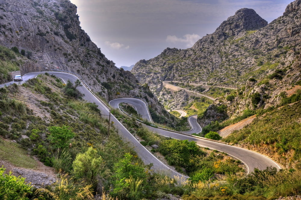
mit Abstecher nach Sa Calobra

Reine Fahrzeit waren 9h 20min, wir haben nicht gebummelt!!

Tour map and elevation profile

  • Open Street Map
  • Google
Minimum height 11 m Maximum height 867 m Detailed view

More about the tour author

Mathis_muc
Member since 2008

Send private message

Comments

GPS tracks

Trackpoints
  • GPX / Garmin Map Source (gpx) download
  • TCX / Garmin Training Center® (tcx) download
  • CRS / Garmin Training Center® (crs) download
  • Google Earth (kml) download
  • G7ToWin (g7t) download
  • TTQV (trk) download
  • Overlay (ovl) download
  • Fugawi (txt) download
  • Kompass (DAV) Track (tk) download
  • Track data sheet (pdf) download
  • Original file of the author (gpx) download

More about the tour author

Mathis_muc
Member since 2008

Send private message
Share track
Add to my favorites
Remove from my favorites
Edit tags
My score
Rate
Track: Mallorca Königstour
Type: Road biking
Distance: 218,5 km
Evaluated on:
Duration:
Day(s)
Hour(s)
Minute(s)
Score: Landscape Fun factor Fitness Technique