

Ausgangspunkt ist der Berggasthof Gibacht (Althütte).
Entlang eines Waldweges erreicht man nach ca 1,5 km den Pfenningfelsen und nach ca. 500 weiteren Metern den Grenzübergang 3 Wappen. Entlang der Grenze geht man leicht bergauf und bergab bis man auf tschechischer Seite einen Forstweg erreicht. Der Weg steigt leicht an nach ca. 6km wird etwas steiler. Kurz vor dem Gipfel erreicht man eine alte Militärstraße die hoch bis zum Gipfel und zum ehemaligen Militärareal führt..
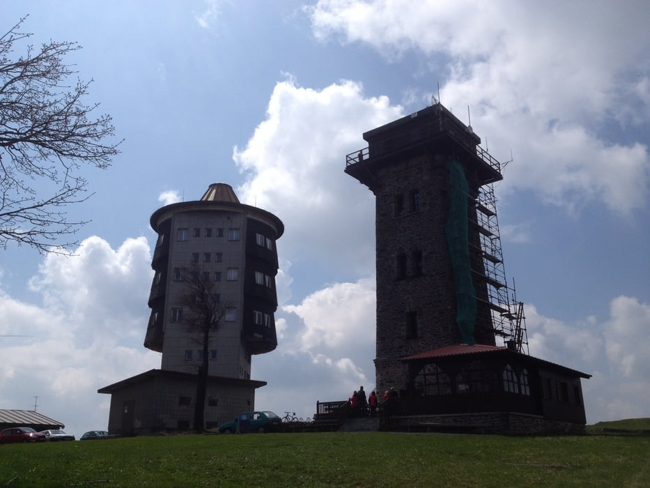
Am Cerchov befindet sich eine ehemalige Radarstation aus der Zeit des Kalten Krieges.
Ein kleine Hütte lädt zu einer Brotzeit ein. Gleich daneben kann man den Aussichtsturm besteigen.
Vom Turm aus überblickt man den gesamten Hauptkamm des Bayerwaldes.
Tour gallery

Tour map and elevation profile
Minimum height 834 m
Maximum height 1048 m
More about the tour author

|
preiste |
Comments

Über Furth im Wald - Richtung Voithenberg / Waldmünchen - bei Althütte rechts hoch Richtung Gibacht
GPS tracks
Trackpoints-
GPX / Garmin Map Source (gpx) download
-
TCX / Garmin Training Center® (tcx) download
-
CRS / Garmin Training Center® (crs) download
-
Google Earth (kml) download
-
G7ToWin (g7t) download
-
TTQV (trk) download
-
Overlay (ovl) download
-
Fugawi (txt) download
-
Kompass (DAV) Track (tk) download
-
Track data sheet (pdf) download
-
Original file of the author (tcx) download
More about the tour author
|
|
preiste |
Add to my favorites
Remove from my favorites
Edit tags
Open track
My score
Rate