


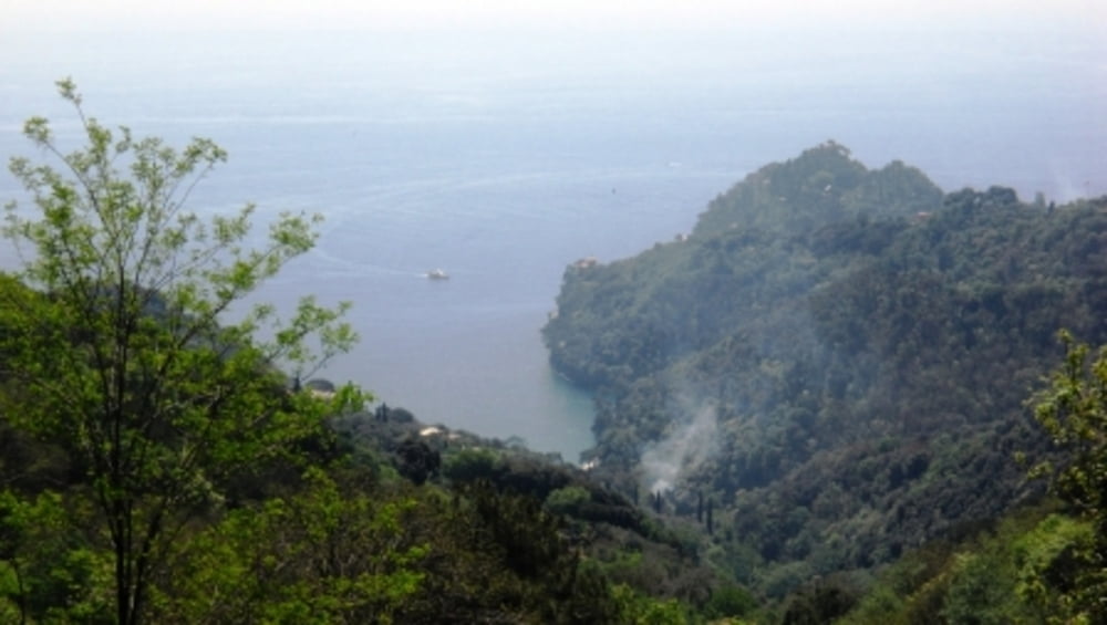
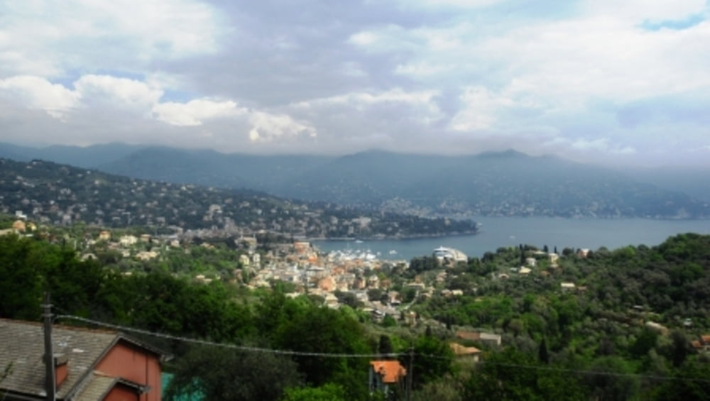
Attraverso la ripida scalinata che trovate a fianco della galleria di Ruta di Camogli, raggiungete la chiesa di San Michele Arcangelo per imboccare Via Gaixella. La mulattiera inizia con una serie di gradini in cemento che salgono tra le abitazioni per proseguire poi con un acciottolato ombreggiato nel bosco. In breve arrivate alle spalle dell' Hotel a Portofino Vetta, dove proseguite in direzione Pietre Strette. Sui inizia a scendere in direzione S. Fruttuoso ma, seguendo il segnavia “T” si piega a sinistra seguendo il nuovo sentiero tracciato da poco tempo. L’itinerario punta in direzione di Santa Margherita Ligure con leggere discese e successive brevi salite. Un bel colpo d’occhio sul golfo di Santa Margherita Ligure si può cogliere quando si arriva alla cappella della Madonna della Neve a Nozarego. Di qui si scende lungo brevi scalinate e percorsi tra fasce e case rurali si entra in città. Seguendo via Maragliano giungete in prossimità del porticciolo. Da piazza Vittorio Veneto è possibile trovare l’autobus per rientrare a Ruta.
Further information at
http://www.parcoportofino.it/HomePage.aspxTour gallery

Tour map and elevation profile
Minimum height 35 m
Maximum height 563 m
More about the tour author
|
|
bonani |
Comments

Per arrivare a Ruta, oltre all’auto, si può utilizzare il treno scendendo alla stazione di Camogli e prendendo successivamente l’autobus linea 73.
GPS tracks
Trackpoints-
GPX / Garmin Map Source (gpx) download
-
TCX / Garmin Training Center® (tcx) download
-
CRS / Garmin Training Center® (crs) download
-
Google Earth (kml) download
-
G7ToWin (g7t) download
-
TTQV (trk) download
-
Overlay (ovl) download
-
Fugawi (txt) download
-
Kompass (DAV) Track (tk) download
-
Track data sheet (pdf) download
-
Original file of the author (gpx) download
More about the tour author
|
|
bonani |
Add to my favorites
Remove from my favorites
Edit tags
Open track
My score
Rate