
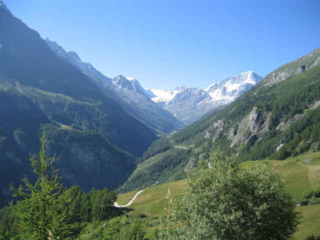

Seit Evolène, Sie folgen die Strecke von "raid Evolainard" MTB race. Am Anfang es gibt ein lange Aufstiege auf Weg. Nachher, es ist auf Single track (mit viel Kurve) und noch lange Austiege zum "alpage de l'étoile".
AM Anfang es ist schnell Weg mit kurve und achtung. IN der mitte von Abfahrt, nehmen Sie Wanderweg links. Es ist ein dünnes single track im Lärchewald mit viel kurze kurve.
Sie folgen die Abfahrte auf Single track zum "les Haudères".
Die zweite Teil ist die Ende von "Raid evolenard" MTB race.
AM Anfang es ist schnell Weg mit kurve und achtung. IN der mitte von Abfahrt, nehmen Sie Wanderweg links. Es ist ein dünnes single track im Lärchewald mit viel kurze kurve.
Sie folgen die Abfahrte auf Single track zum "les Haudères".
Die zweite Teil ist die Ende von "Raid evolenard" MTB race.
Tour map and elevation profile
Minimum height 1390 m
Maximum height 2351 m
More about the tour author

|
preusser |
Comments

GPS tracks
Trackpoints-
GPX / Garmin Map Source (gpx) download
-
TCX / Garmin Training Center® (tcx) download
-
CRS / Garmin Training Center® (crs) download
-
Google Earth (kml) download
-
G7ToWin (g7t) download
-
TTQV (trk) download
-
Overlay (ovl) download
-
Fugawi (txt) download
-
Kompass (DAV) Track (tk) download
-
Track data sheet (pdf) download
-
Original file of the author (gpx) download
More about the tour author
|
|
preusser |
Add to my favorites
Remove from my favorites
Edit tags
Open track
My score
Rate