


Schweinfelsen - Lindelbrunn
Kurz und knapp
Schwierigkeitsgrad laut Singletrail-Skala: S1
Gesamtstrecke: 30,1 km
Singeltrailanteil > 50%
Straße: ca.8%
Forststraße
Höhenmeter: ca. 820
Dauer: 2,5 Stunden
Parkplatz: Am Wild- und Wanderpark in Silz
Highlights:
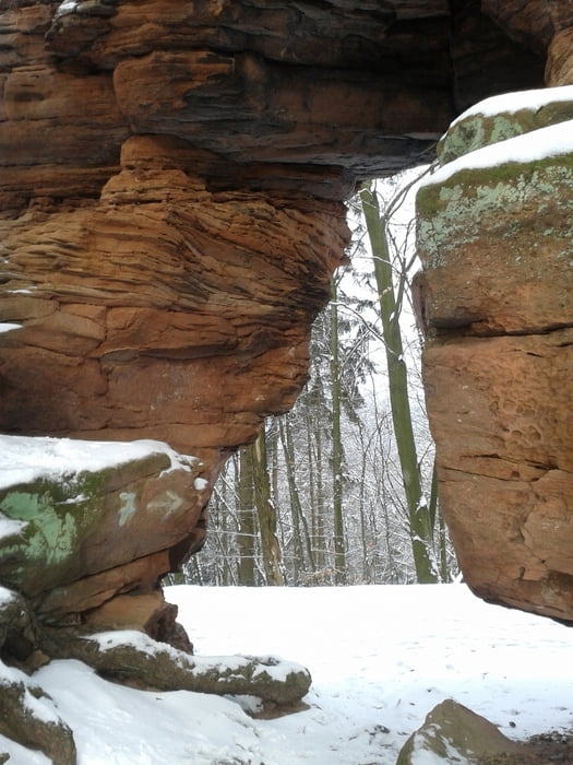
Felsdurchfahrt am Kellerfels
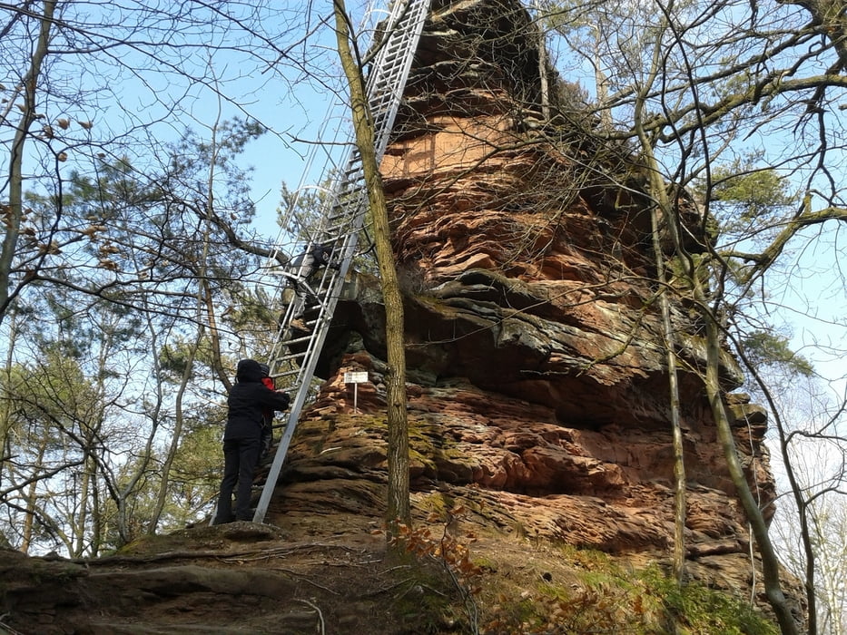
Schweinfelsen
Burgruine Lindelbrumm
Einkehrmöglichkeiten:
Cramerhaus
Bühlhofschänke
Wasgauhütte
Gaststätte am Wild- und Wanderpark
Tourverlauf:
Geparkt wird auf dem Parkplatz des Wild- und Wanderparks in Silz. Von dort geht es parallel zur Straße auf einem Pfad in Richtung Bethof, dann auf blauem Kreuz hoch. Spektakuläre Felsdurchfahrt am Kellerfels auf dem Waldweg hoch zum Schweinsfels. Auf jeden Fall dort mit Hilfe der Himmelsleiter hoch und die Aussicht über die Südpfalz genießen. Von dort weiter zur Burgruine Lindelbrunn. In Oberschlettenbach hoch zum Bühlhof und auf dem Bergrücken weiter und den Schotterweg runter. Achtung, vor der Wasgauhütte nach rechts und auf rotem Punkt weiter bis zum Silzer See. Wenn der letzte Anstieg weggelassen wird, kann man sich dort ca. 140 hm sparen.
Further information at
http://www.cramerhaus.deTour gallery
Tour map and elevation profile
Minimum height 143 m
Maximum height 444 m
More about the tour author
|
|
klondike |
Comments
Parkplatz am Wild- und Wanderpark in Silz
GPS tracks
Trackpoints-
GPX / Garmin Map Source (gpx) download
-
TCX / Garmin Training Center® (tcx) download
-
CRS / Garmin Training Center® (crs) download
-
Google Earth (kml) download
-
G7ToWin (g7t) download
-
TTQV (trk) download
-
Overlay (ovl) download
-
Fugawi (txt) download
-
Kompass (DAV) Track (tk) download
-
Track data sheet (pdf) download
-
Original file of the author (gpx) download
More about the tour author
|
|
klondike |
Add to my favorites
Remove from my favorites
Edit tags
Open track
My score
Rate
Schweinsfels
bin den östlichen Teil abgefahren, hatte danach aber keine Lust mehr...
Mehr als 50% Singletrails? Auf 17km 2 mal 200m Singletrail. Sorry, Schweinsfels und Lindelbrunn sind schön, eine Singletrailtour ist das aber nicht mal ansatzweise. Bitte in Zukunft realistische Angaben.
VG