Login

Forgotten password?

Cookies have to be accepted!
Your browser's cookie functionality is disabled. Please enable this functionality.

Not a member yet?

Register now
Login

Available for registred users only

Log in to use this feature.

Forgotten password?

Cookies have to be accepted!
Your browser's cookie functionality is disabled. Please enable this functionality.

Not a member yet?

Register now
Filter
Categories
Advanced filters
  • Distance (km)
  • Height
Save filters Reset filter

TrackRank

QRCode

Technical data

Distance15,5 km Height1579 m Way down1578 m Duration09:00 h:m Date16.08.2013
Scores Author User Landscape Fun factor Fitness Technique

Statistics

295 Views Scores 11 Downloads Average
Rate
  • Track data sheet
  • Directions
  • Downloads

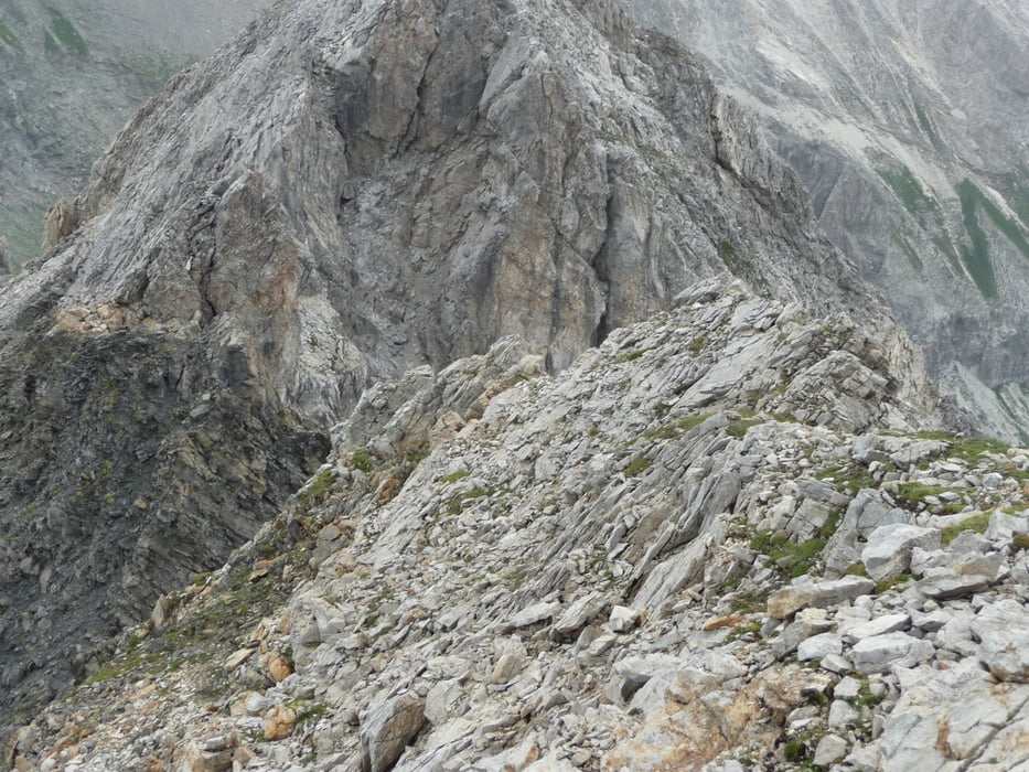
Es wurde geplant von Zederhaus nach Tweng durch Hochfeind und Weisseneck Spitzen zu gehen. Aber Markirungen nach den Hochfeindspitze sind keine mehr. Das wegen bin ich zurück gekehrt. Achtung! Route ist zimmlich schwer und es gibt's 2-3 Stellen die ein bißchen gefährlich sind. Gute Schuhe, Wetter und Ruhe erforderlich.


Further information at

http://goo.gl/maps/iQKcp

Tour gallery

Tour map and elevation profile

  • Open Street Map
  • Google
Minimum height 1222 m Maximum height 2653 m Detailed view

More about the tour author

copyright
Member since 2013

Send private message

Comments

Für Navi: Rothenwand 81, 5584 Rothenwand, Österreich


GPS tracks

Trackpoints
  • GPX / Garmin Map Source (gpx) download
  • TCX / Garmin Training Center® (tcx) download
  • CRS / Garmin Training Center® (crs) download
  • Google Earth (kml) download
  • G7ToWin (g7t) download
  • TTQV (trk) download
  • Overlay (ovl) download
  • Fugawi (txt) download
  • Kompass (DAV) Track (tk) download
  • Track data sheet (pdf) download
  • Original file of the author (gpx) download

More about the tour author

copyright
Member since 2013

Send private message
Share track
Add to my favorites
Remove from my favorites
Edit tags
My score
Rate
Track: Hochfeindspitze (Lungau, Österreich)
Type: Hiking
Distance: 15,5 km
Evaluated on:
Duration:
Day(s)
Hour(s)
Minute(s)
Score: Landscape Fun factor Fitness Technique