Login

Forgot your login?

Cookies have to be accepted!
Your browser's cookie functionality is disabled. Please enable this functionality.

Not a member yet?

Register now
Login

Available for registred users only

Log in to use this feature.

Forgot your login?

Cookies have to be accepted!
Your browser's cookie functionality is disabled. Please enable this functionality.

Not a member yet?

Register now
Filter
Categories
Advanced filters
  • Distance (km)
  • Height
Save filters Reset filter

TrackRank

QRCode

Technical data

Distance79,8 km Height1167 m Way down1176 m Duration04:00 h:m Date17.08.2013
Scores Author User Landscape Fun factor Fitness Technique

Statistics

1353 Views 3 Scores 94 Downloads 4.67 Average
Rate
  • Track data sheet
  • Directions
  • Downloads

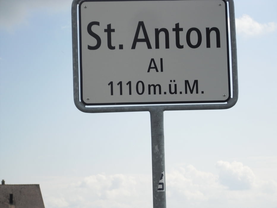
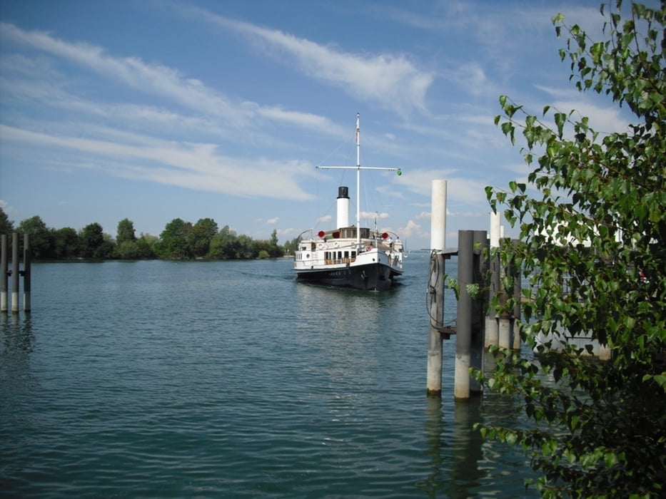
Von Lindau/Bodensee nach Bregenz (A) und entlang des Rheindamms nach Altstätten(CH). Hier beginnt der Anstieg zum Ruppenpass. Auf Passhöhe beim Gasthaus Landmark (1003m) gehts nun rechts nach St. Anton (CH) mit super Aussicht auf Rheintal, Bodensee und Säntis. Über Oberegg und Au kommen wir zurück nach Hard mit Abstecher zur Anlegestelle der Hohentwiel. Weiter vorbei am Kloster Mehrrerau nach Bregenz und Lindau.


Tour gallery

Tour map and elevation profile

  • Open Street Map
  • Google
Minimum height 377 m Maximum height 1109 m Detailed view

More about the tour author

Bockrider
Member since 2007

Send private message

Comments

woerni on 06.10.2013

Super schöne Tour

Macht echt viel Spaß, auch wenn der Anstieg nicht ganz ohne ist. Aber das Panorama oben entschädigt dann wieder.
peterchenonline on 08.11.2013

Meine Hausrunde

Eine Superrunde, die ich jedem empfehlen kann.
Sehr interessant ist auch der Abstecher von Oberegg nach Rehetobel. Wenig befahren und flowig.

Grüsse aus St.Gallen
Peter

Start in Lindau / Bodensee Nähe MC-Donalds.


GPS tracks

Trackpoints
  • GPX / Garmin Map Source (gpx) download
  • TCX / Garmin Training Center® (tcx) download
  • CRS / Garmin Training Center® (crs) download
  • Google Earth (kml) download
  • G7ToWin (g7t) download
  • TTQV (trk) download
  • Overlay (ovl) download
  • Fugawi (txt) download
  • Kompass (DAV) Track (tk) download
  • Track data sheet (pdf) download
  • Original file of the author (gpx) download

More about the tour author

Bockrider
Member since 2007

Send private message
Share track
Add to my favorites
Remove from my favorites
Edit tags
My score
Rate
Track: Lindau-Ruppenpass-St.Anton(CH)-Bregenz
Type: Road biking
Distance: 79,8 km
Evaluated on:
Duration:
Day(s)
Hour(s)
Minute(s)
Score: Landscape Fun factor Fitness Technique