
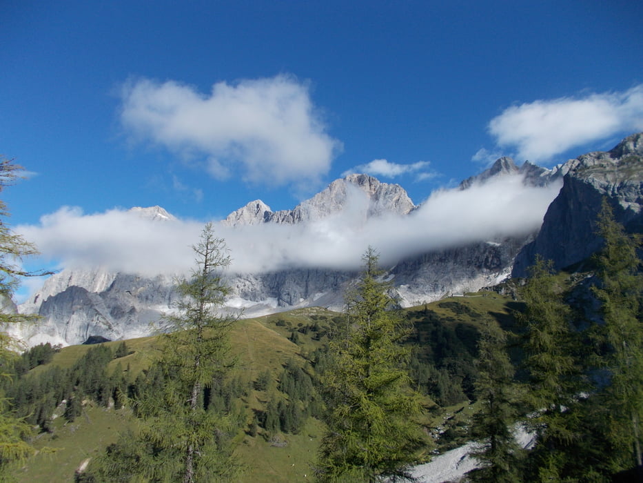

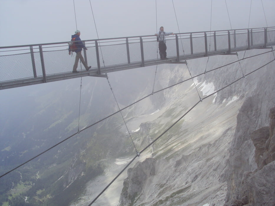
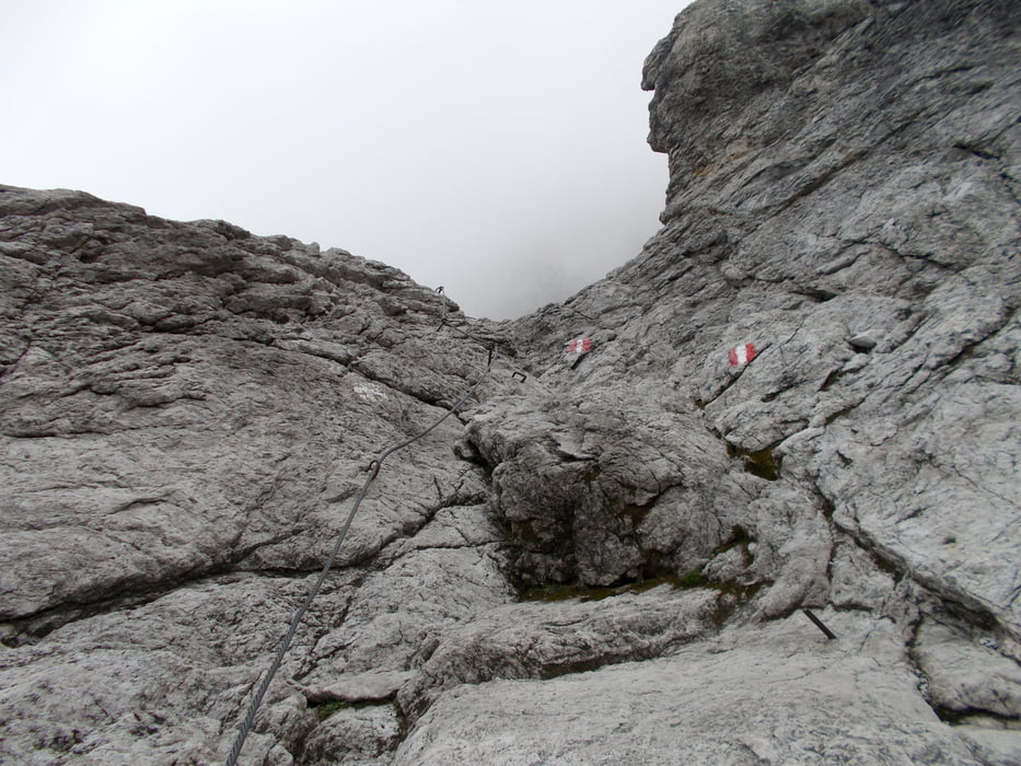
A felvonó alsó állomásánál lévő parkolóból indultunk,sajnos csak fél tíz körül(szeptember elején voltunk),így nem jutott időnk a főcsúcsra felmenni.Nem sokan araszoltak velünk még ezen az úton,nyáron biztos többen vannak.Az utolsó szakaszon vasalt út van,kb.B-s nehézségű.
Tour gallery

Tour map and elevation profile
Minimum height 1661 m
Maximum height 2705 m
More about the tour author
|
|
frontera74 |
Comments

Kocsival a felvonó parkolójáig,fizetni visszafelé kell.Ha használtuk a felvonót,akkor a mágneskártyát felmutatva ingyenes az út használata.
GPS tracks
Trackpoints-
GPX / Garmin Map Source (gpx) download
-
TCX / Garmin Training Center® (tcx) download
-
CRS / Garmin Training Center® (crs) download
-
Google Earth (kml) download
-
G7ToWin (g7t) download
-
TTQV (trk) download
-
Overlay (ovl) download
-
Fugawi (txt) download
-
Kompass (DAV) Track (tk) download
-
Track data sheet (pdf) download
-
Original file of the author (gpx) download
More about the tour author
|
|
frontera74 |
Add to my favorites
Remove from my favorites
Edit tags
Open track
My score
Rate