


Vom Parkplatz bei der Jausenstation (WP 018) folgen wir den Markierungen Nr. 44 über den Leiterlstein hinunter zur Wallfahrtskirche Hilkering (WP 15).
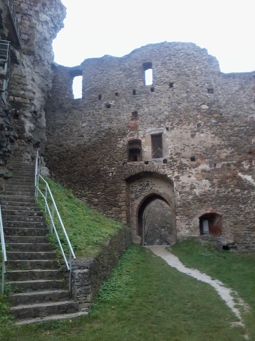
Auf Güterwegen über Rienberg zur Straße nach Strohheim, dieser kurz aufwärts, bis links ein Waldweg zur Ruine Schaunburg (WP 16) weist. Ein kleiner Eintrittspreis ist zu bezahlen und dann steht der Besichtigung der Burganlage nichts mehr im Wege. Schautafeln geben Einblick in die Geschichte der Burg.
Weiter auf der Straße bis rechts eine Zufahrtsstraße zur Markierung Nr. 24 leitet. Dieser folgen auf den Mayrhofberg (WP17). Von dort ist der Ausgangspunkt schon wieder sichtbar.
Further information at
http://www.donausteig.comTour gallery
Tour map and elevation profile
Minimum height 259 m
Maximum height 654 m
More about the tour author

|
JoHangler |
Comments

Von Eferding über Stroheim der Beschilderung zum Mayrhofberg folgen.
GPS tracks
Trackpoints-
GPX / Garmin Map Source (gpx) download
-
TCX / Garmin Training Center® (tcx) download
-
CRS / Garmin Training Center® (crs) download
-
Google Earth (kml) download
-
G7ToWin (g7t) download
-
TTQV (trk) download
-
Overlay (ovl) download
-
Fugawi (txt) download
-
Kompass (DAV) Track (tk) download
-
Track data sheet (pdf) download
-
Original file of the author (gpx) download
More about the tour author
|
|
JoHangler |
Add to my favorites
Remove from my favorites
Edit tags
Open track
My score
Rate