


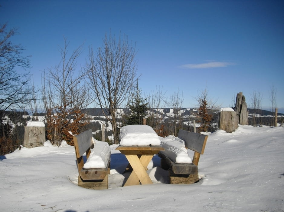
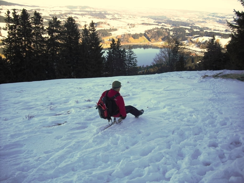
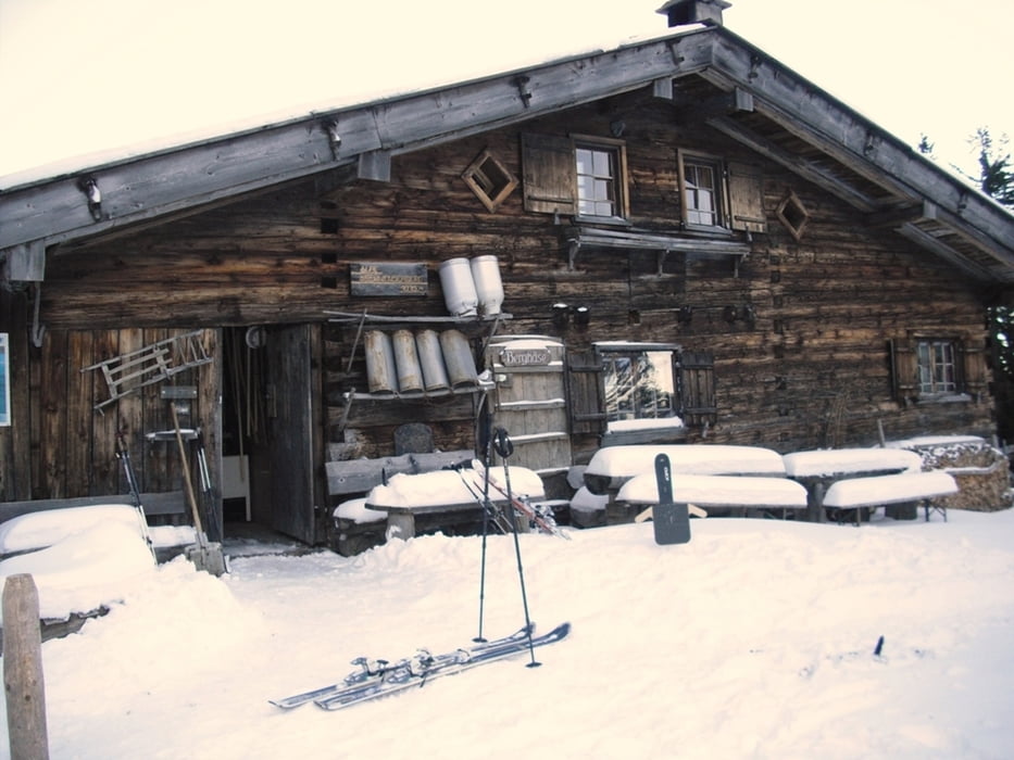
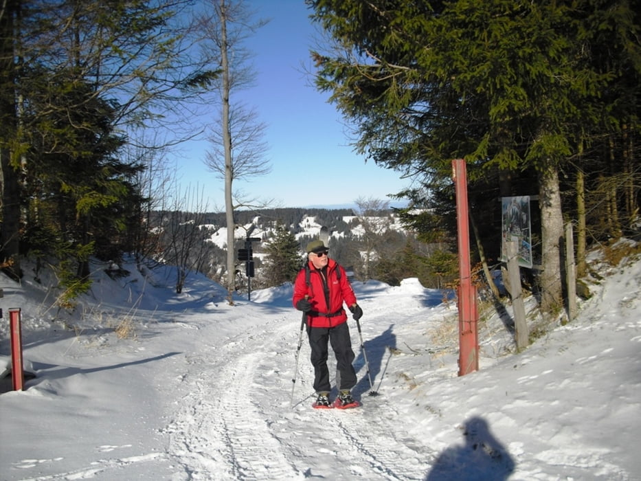
Schneeschuhtour ideal als Einsteigertour geeignet. Wir starten beim Parkplatz Gschwend und vorbei am Schullandheim, erst auf der Strasse dann auf Schnee Richtung Alpsee Bergwelt. Vorbei an der Pionierhütte kommen wir zur Starketsgund Alpe. Von hier gibts eine gute Aussicht auf Alpsee und Salmaser Höhe. Weiter durch einen kleinen Tobel, gehts nun zur Alpe Gschwenderberg. Mit 350 Jahren eine der Ältesten Sennalpen des Allgäus und entsprechend rustikal. Hier gibts (am Wochenende) geniale Käsespätzle und Kaiserschmarren. Wir sind von hier mit dem Schlitten abgefahren, deshalb auf der Anliegerstrasse. Ohne Schlitten wäre der (beschilderte) Weg direkt von der Alpe nach Gschwend der kürzere Weg.
Further information at
http://www.alpegschwenderberg.deTour gallery
Tour map and elevation profile
Minimum height 803 m
Maximum height 1221 m
More about the tour author
|
|
Bockrider |
Comments

Von Immenstadt Richtung Oberstaufen B308, in Bühl bergwärts nach Gschwend. (Kostenpflichtiger) Parkplatz nach einem Bauernhof.
GPS tracks
Trackpoints-
GPX / Garmin Map Source (gpx) download
-
TCX / Garmin Training Center® (tcx) download
-
CRS / Garmin Training Center® (crs) download
-
Google Earth (kml) download
-
G7ToWin (g7t) download
-
TTQV (trk) download
-
Overlay (ovl) download
-
Fugawi (txt) download
-
Kompass (DAV) Track (tk) download
-
Track data sheet (pdf) download
-
Original file of the author (gpx) download
More about the tour author
|
|
Bockrider |
Add to my favorites
Remove from my favorites
Edit tags
Open track
My score
Rate