


Ein Tag ist für einen Besuch im Death Valley NP definitiv zu wenig. Erst recht wenn man erst aus Barstrow anreist.
So waren wir erst gegen Mittag in Shoshone und tasteten uns langsam über die Badwater Road in Richtung Furnace Creek Inn vor. Jede Menge Fotomotive. Zu empfehlen ist auf alle Fälle ein Abstecher über den Artists Drive zur Artists Palette. Die bunten Felsen laden zu einer Erkundung zu Fuß ein und hier ist man fast unter sich.
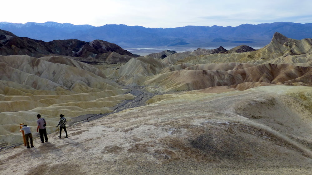
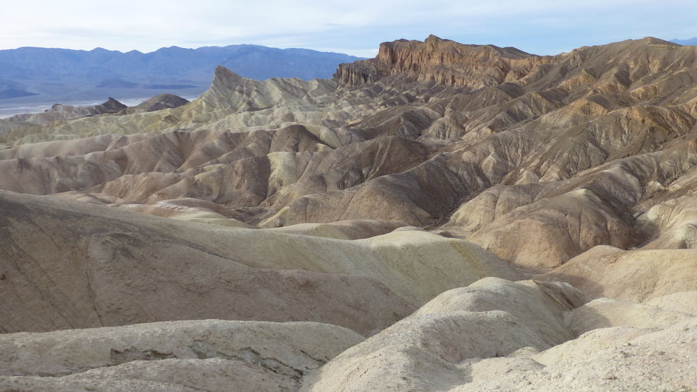
Für eine ausgiebige Wanderung hat es dann zeitlich leider nicht mehr gereicht. Eigentlich hatte ich vor, von unten durch den Golden Canyon zum Zabriski Point aufzusteigen und dann durch die auf den Fotos zu sehende Mondlandschaft wieder ins Death Valley zurückzukehren.
Also ging es mit dem Auto zum Zabriski Point.
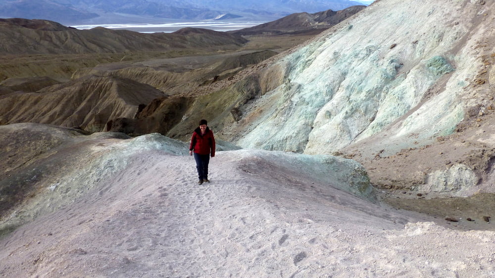
Unsere kleine Wanderung bietet allerdings auch einen schönen Einblick in diese besondere Landschaft. Man sollte das Gelände jedoch nicht unterschätzen. Die Buckel werden nach unten immer steiler und wenn man erst einmal ins Rutschen gekommen ist, hält einen nichts mehr.
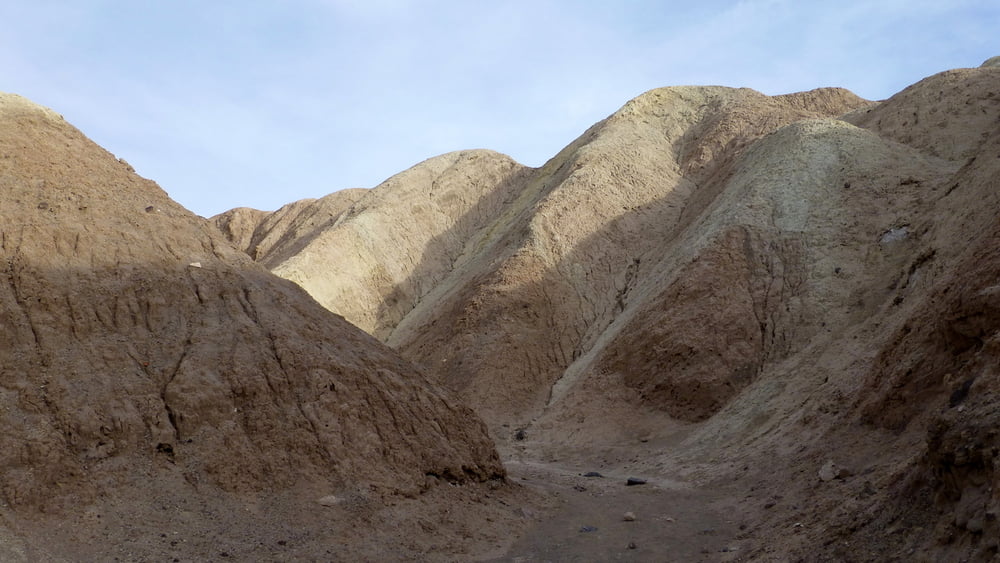
Unser Track verlässt die ummauerte Besucherplattform seitlich und folgt einem Trampelpfad bis in eine Wash. In diesem geht es dann wieder aufwärts bis zum Parkplatz.
Bis Pahrump ist es dann noch knapp eine Stunde.
Further information at
http://www.nps.gov/deva/index.htmTour gallery
Tour map and elevation profile
Minimum height 206 m
Maximum height 265 m
More about the tour author
|
|
ds5 |
Comments

Traveling by Car
The main road transecting Death Valley National Park from east to west is California Highway 190.
On the east in Nevada, U.S. Route 95 parallels the park from north to south with connecting highways at Scotty's Junction (State Route 267), Beatty (State Route 374), and Lathrop Wells (State Route 373).
The most direct route from Las Vegas (via Pahrump, NV) and other options are available by downloading Routes From Las Vegas (191kb PDF file)
Coming from the west, State Route 14 and U.S. Route 395 lead to Ridgecrest, CA where State Route 178 heads east into the park. Further north on Hwy 395 at Olancha, CA you can join Hwy 190 to the park, or north of that at Lone Pine, CA, Hwy 136 will also join Hwy 190 heading east into the park.
South of the park, Interstate 15 passes through Baker, California on its way from Los Angeles to Las Vegas. State Route 127 travels north from Baker to Shoshone and Death Valley Junction with connections to the park on State Route 178 from Shoshone and connection with California Highway 190 at Death Valley Junction.
Using GPS Navigation
GPS Navigation to sites to remote locations like Death Valley are notoriously unreliable. Numerous travelers have been directed to the wrong location or even dead-end or closed roads. Travelers should always carry up-to-date road maps to check the accuracy of GPS directions.
DO NOT DEPEND ONLY ON YOUR VEHICLE GPS NAVIGATION SYSTEM.
There is no specific street address for the park or the Furnace Creek Visitor Center. Many GPS users have had success using the street address for the Death Valley Post Office which is located about 400 meters south of the visitor center.
The post office address is:
328 Greenland Blvd.
Death Valley, CA 92328
Map coordinates for the visitor center are:
N 36°27.70
W 116°52.00
Public Transportation
At this time, there is no public transportation available to Death Valley National Park.
GPS tracks
Trackpoints-
GPX / Garmin Map Source (gpx) download
-
TCX / Garmin Training Center® (tcx) download
-
CRS / Garmin Training Center® (crs) download
-
Google Earth (kml) download
-
G7ToWin (g7t) download
-
TTQV (trk) download
-
Overlay (ovl) download
-
Fugawi (txt) download
-
Kompass (DAV) Track (tk) download
-
Track data sheet (pdf) download
-
Original file of the author (gpx) download
More about the tour author
|
|
ds5 |
Add to my favorites
Remove from my favorites
Edit tags
Open track
My score
Rate