


Kilimanjaro - Machame Route (Whiskey route)
Start: 18/03/2014, 13:00, Machame Gate
End: 23/03/2014, 11:00, Mweka Gate
Keywords: altitude sickness, Stella Point, Uhuru Peak, Kilimanjaro, Machame Route
Tuesday, 18/03/2014
Start at Machame Gate at 13.00 after a 2h ride from Marangu in a bus with our porters, cook, waiter and guides (20 persons of staff in total). We ascend from Machame Gate at roughly 1800m to Machame Camp at roughly 3000m within 3.30h of pure walking time.
Wednesday, 19/03/2014
We start at 09.00 and arrive at Shira Caves Camp after 4.30h of walking, having gained 850 m. By leaving Machame Huts Camp we have also left the rain forrest and enter an area consisting of low bushes, moss and trees. At Shira Caves Camp the landscape is already moon like. At night, the temperature drops below zero.
Thursday, 20/03/2014
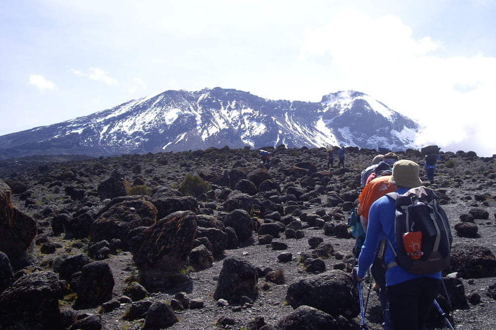
We start ascending to Lava Tower at an altitude of 4630 m. Starting at 4200 m, the scenery is marked by a rocky, moon like landscape bare of plants. At Lava Tower, we face altitude sickness in the form of a headache. After a short break we descend to Barranco Camp at 3980 m. The net walking time of this day is 5.40h. Again, the temperture during the night falls below 0°.
Friday, 21/03/2014
We begin our 6.00h walk (net walking time) to Barafu Camp. The famous Barranco wall is not really a major problem as long as one uses ones hands when needed. We make our lunch break at the Karanga Valley campsite (4040 m) prior to continuing upwards to our destination, Barafu Camp (4660 m). After walking through rain and snow during the next 3h we arrive at Barafu Camp. At nightfall, the temperatures quickly drop from 0° to a couple degrees below zero.
Friday/Saturday, 22/03/2014
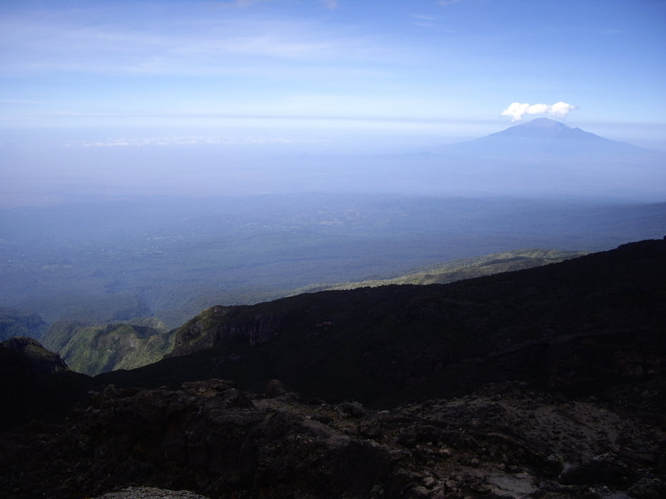
We are woken up at 23.00h for some tee and biscuits and start the final 6h ascent (net walking time) to the summit of Mt. Kilimanjaro after few hours of sleep in multiple layers of clothes. The first hours of the climb lead through snowy scree while our headlamps only enlighten few meters in front of our feet. Despite 4 layers of clothing on our legs and 5 layers on our upper bodies and balaclavas on our heads we quickly feel cold when taking a break due to the icy wind from the glacier. We try to keep altitude sickness in check by taking breaks when needed and by taking it really slow. Nevertheless, after a few hours of acent, one of our group has to give up due to severe altitude sickness including vomiting and difficulty to breathe. From 5300 m on, I have the feeling that I rather tumble up the mountain instead of walking normally. This continues until the sun rises and we finally see the summit in the first light of the day. Nevertheless, the final 2h to Stella point, the first peak of Mt. Kilimanjaro, are pure physical and mental torture requiring all of our strength. The last 50m of altitude before reaching Stella Point are extremely difficult due to the steepness, shortage of oxygen and nausea. However, after 20 minutes, also this last piece to Stella point is covered and we stand on top of the mountain. Only one of us continues to Uhuru Peak, the others relax in the sunlight of Stella Point for a couple of minutes, take some pictures and then start the 3h descent to Barafu Camp through blinding snow.
Back at the camp, we sleep for one hour, have lunch and then leave for the Mweka Huts Camp at 3100 m altitude, which takes us another 3.5h of walking downhill. The total walking time on this day is 12.5h.
Sunday, 23/03/2014
On the following morning, we descend down to Mweka Gate, located at 1750m, in about 2.30h. There, we pick up our certificates at the ranger's hut and return to Marangu via the touristic village near the Mweka Gate (If you intend to acquire some souvenirs in exchange for some of your clothes or some of your equipment, the village just below Mweka Gate is a suitable place to do so).
Useful literature
Henry Stedman, "Kilimanjaro - The trekking guide to Africa's highest mountain", 3rd edition, published 2010.
Note
The gpx track of the first two days, comprising the tracks from Machame Gate to Machame Camp and further to Shira Caves Camp has been copied from http://www.mapmyhike.com/es/guadix-andalusia/kilimanjaro-machame-route-4909943.
The remaining days correspond to my own GPS log for which the altitude profile can be seen below.
Tour gallery
Tour map and elevation profile
Minimum height 1670 m
Maximum height 5742 m
More about the tour author
|
|
blobic |
Comments

GPS tracks
Trackpoints-
GPX / Garmin Map Source (gpx) download
-
TCX / Garmin Training Center® (tcx) download
-
CRS / Garmin Training Center® (crs) download
-
Google Earth (kml) download
-
G7ToWin (g7t) download
-
TTQV (trk) download
-
Overlay (ovl) download
-
Fugawi (txt) download
-
Kompass (DAV) Track (tk) download
-
Track data sheet (pdf) download
-
Original file of the author (gpx) download
More about the tour author
|
|
blobic |
Add to my favorites
Remove from my favorites
Edit tags
Open track
My score
Rate