


Singen-Nöttingen-Ellmendingen-Ottenhausen-Schwann-Dobel-Dürreych-Eyachmühl
e-Dennach-Schwann-Niebelsbach-Ellendingen-Singen. ZUm größten Teil gut Waldwege mit ein paar Trails. Bis zum Dobel ist es etwas anstrengend, aber dann richtig schön.
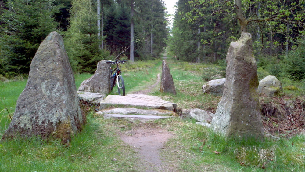
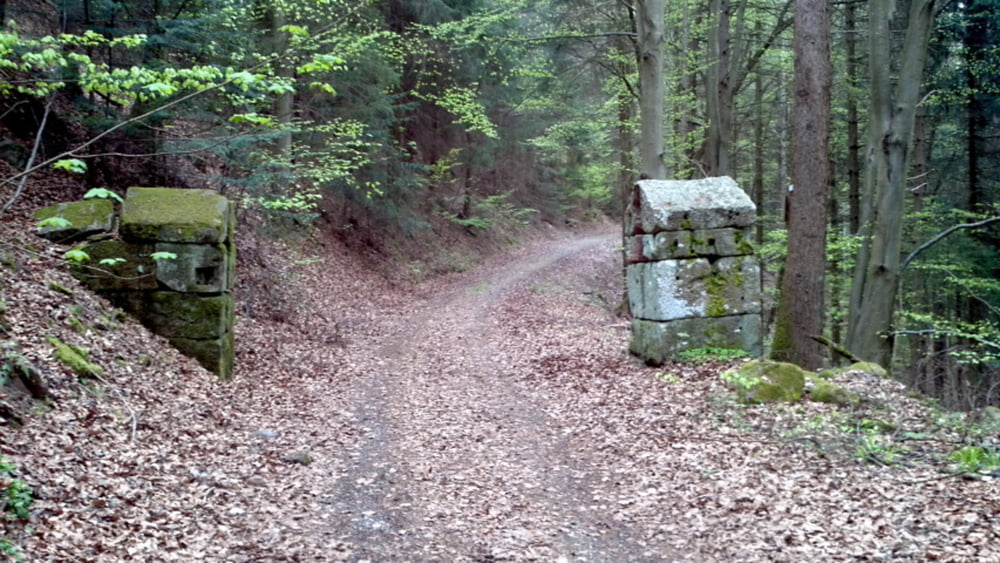
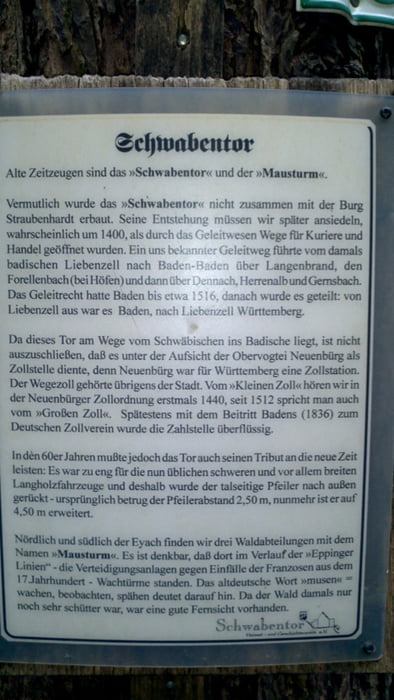
Auf Höhe von Dennach befindet sich das Schwabentor. Der Heimatverein Dennach hat hier ein Beschreibung : www.schwabentor.com/schwabentor/das_schwabentor.htm
Technik = STS Klassifizierung: Link www.singletrail-skala.de/overview
Tour gallery
Tour map and elevation profile
Minimum height 99 m
Maximum height 721 m
More about the tour author

|
tsx56 |
Comments

GPS tracks
Trackpoints-
GPX / Garmin Map Source (gpx) download
-
TCX / Garmin Training Center® (tcx) download
-
CRS / Garmin Training Center® (crs) download
-
Google Earth (kml) download
-
G7ToWin (g7t) download
-
TTQV (trk) download
-
Overlay (ovl) download
-
Fugawi (txt) download
-
Kompass (DAV) Track (tk) download
-
Track data sheet (pdf) download
-
Original file of the author (gpx) download
More about the tour author
|
|
tsx56 |
Add to my favorites
Remove from my favorites
Edit tags
Open track
My score
Rate