Login

Forgotten password?

Cookies have to be accepted!
Your browser's cookie functionality is disabled. Please enable this functionality.

Not a member yet?

Register now
Login

Available for registred users only

Log in to use this feature.

Forgotten password?

Cookies have to be accepted!
Your browser's cookie functionality is disabled. Please enable this functionality.

Not a member yet?

Register now
Filter
Categories
Advanced filters
  • Distance (km)
  • Height
Save filters Reset filter

TrackRank

QRCode

Technical data

Distance13,5 km Height755 m Way down760 m Duration04:00 h:m Date21.04.2014
Scores Author Landscape Fun factor Fitness Technique

Statistics

481 Views Scores 23 Downloads Average
Rate
  • Track data sheet
  • Directions
  • Downloads

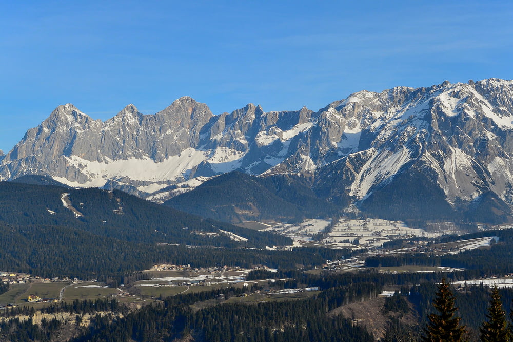
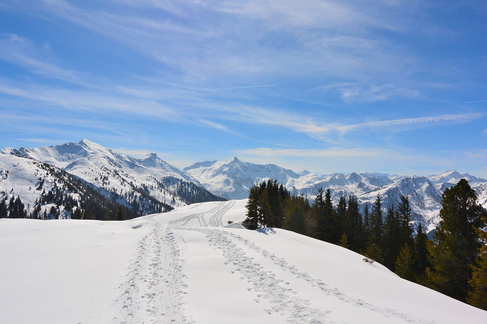
Schneeschuhwanderung von der Talstation der Hochwurzen-Seilbahn über das Rossfeld und retour.

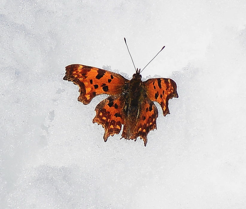
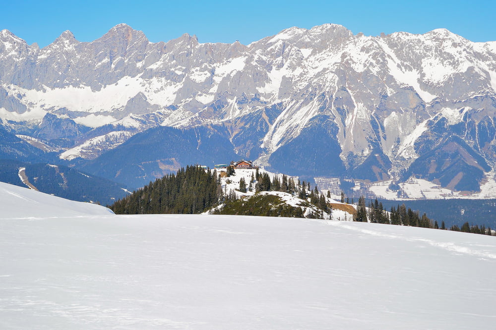
Das Rossfeld bietet eine herrliche Rundumsicht. Für uns überraschend flog uns in der ersten Märzhälfte in knapp 2000 m Höhe ein Schmetterling entgegen und machte eine kurze Rast zum Fotografieren.


Further information at

http://www.hochwurzen.at/de/

Tour gallery

Tour map and elevation profile

  • Open Street Map
  • Google
Minimum height 1254 m Maximum height 1926 m Detailed view

More about the tour author

LeoPix
Member since 2013

Send private message

Comments

Mit dem Auto bis zum Parkplatz der Seilbahnstation des Hochwurzen 2 Fun Jet.


GPS tracks

Trackpoints
  • GPX / Garmin Map Source (gpx) download
  • TCX / Garmin Training Center® (tcx) download
  • CRS / Garmin Training Center® (crs) download
  • Google Earth (kml) download
  • G7ToWin (g7t) download
  • TTQV (trk) download
  • Overlay (ovl) download
  • Fugawi (txt) download
  • Kompass (DAV) Track (tk) download
  • Track data sheet (pdf) download
  • Original file of the author (gpx) download

More about the tour author

LeoPix
Member since 2013

Send private message
Share track
Add to my favorites
Remove from my favorites
Edit tags
My score
Rate
Track: Hochwurzen Rossfeld
Type: Snowshoeing
Distance: 13,5 km
Evaluated on:
Duration:
Day(s)
Hour(s)
Minute(s)
Score: Landscape Fun factor Fitness Technique