


- Start/Ziel: Meran/Postbrücke-Sissipark.
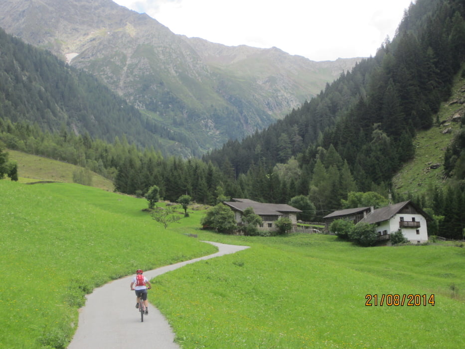
- Auf dem Passeiertal-Radweg(Schotter) bis St.Leonhard(KM 14,9-MH 580)
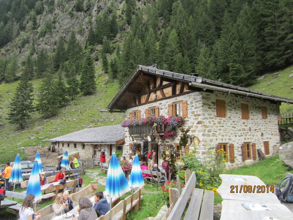
- Aufstieg auf Asfalt(mittelsteil) bis Gastohof Pfandlerhof.
- Ab KM 20,6-MH 1.130 auf Schotterweg bergauf, vorbei an der Abzweigung zur Pfandleralm bis zu einem Heustadel. Ab dem Begrenzungsgitter geht es in einigen Abschnitten richtig zur Sache. Entweder man hat ein E-Bike, oder schieben ist angesagt.
- Höchster Punkt KM 25-MH 1.640.
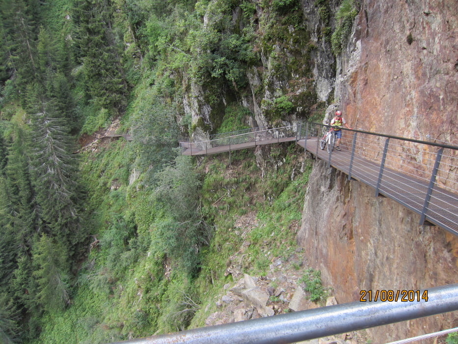
- Ein im senkrechten Felsen befestigte Eisenkonstruktion in Form eines Steiges führt hinunter Richtung Prantacher Alm (KM 26,6-MH 1.455). Technisch versierte Fahrer meistern das Teilstück vom Eisernen Steig bis zur Forststrasse auf auf gerölligem Untergrund auch im Sattel, ansonsten ist ein wenig schieben notwendig.
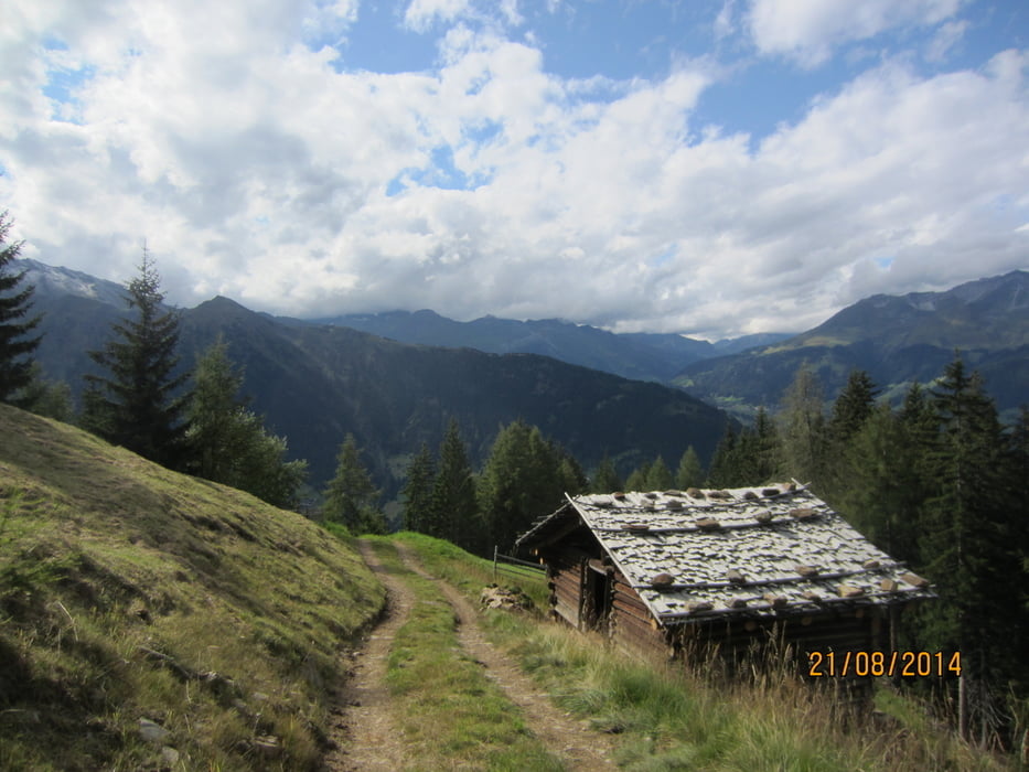
- Von der Alm auf Schotter/Asfalt hinunter ins Tal und von St.Martin ausrollen auf dem Radweg bis Meran.
Rundkurs gegen den Uhrzeigersinn.
Tour gallery

Tour map and elevation profile
Minimum height 274 m
Maximum height 1650 m
More about the tour author
|
|
MargesinFriedrich |
Comments

GPS tracks
Trackpoints-
GPX / Garmin Map Source (gpx) download
-
TCX / Garmin Training Center® (tcx) download
-
CRS / Garmin Training Center® (crs) download
-
Google Earth (kml) download
-
G7ToWin (g7t) download
-
TTQV (trk) download
-
Overlay (ovl) download
-
Fugawi (txt) download
-
Kompass (DAV) Track (tk) download
-
Track data sheet (pdf) download
-
Original file of the author (gpx) download
More about the tour author
|
|
MargesinFriedrich |
Add to my favorites
Remove from my favorites
Edit tags
Open track
My score
Rate