
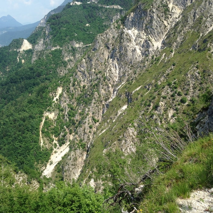

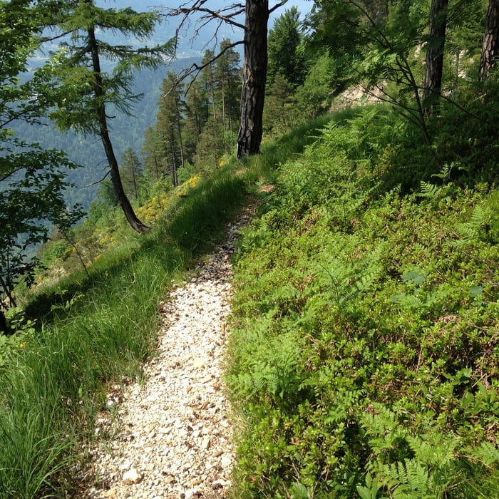
Wir starten in Caldonazzo Richtung Monterovere und fahren auf Teer von ca. 500 m auf 1250 Meter Höhe. Wir biegen dann nach rechts in einen Schotterweg und orientieren uns immer am sentiero della pace (Friedenstaube). Nach Slaghenaufi könnten wir sogar noch abkürzen (rechts halten). In der Nähe von Dosso Tomazol beginnt der Trail. Feinster 600hm Singletrail wartet auf uns. An den schwierigen technischen Passage, an denen es steil bergab geht muss geschoben werden. Es ist zu gefährlich! Absolute Schwindelfreiheit ist notwendig und Höhenangst sollten man nicht haben. Die Aussicht ist genial. Es ist vieleicht einer der schönsten alpinen Singletrails. Ab ca. HM 650 geht es nochmal rechts weg in einen wilden Trail, der im Sommer manchmal zugewachsen ist. In der letzten Zeit wird er jedoch stark befahren. In Caldonazzo haben wir uns ein Eis verdient. Viel Spass!!!
Tour gallery
Tour map and elevation profile
Minimum height 491 m
Maximum height 1364 m
More about the tour author

|
dottore66 |
Comments

GPS tracks
Trackpoints-
GPX / Garmin Map Source (gpx) download
-
TCX / Garmin Training Center® (tcx) download
-
CRS / Garmin Training Center® (crs) download
-
Google Earth (kml) download
-
G7ToWin (g7t) download
-
TTQV (trk) download
-
Overlay (ovl) download
-
Fugawi (txt) download
-
Kompass (DAV) Track (tk) download
-
Track data sheet (pdf) download
-
Original file of the author (gpx) download
More about the tour author
|
|
dottore66 |
Add to my favorites
Remove from my favorites
Edit tags
Open track
My score
Rate