Login

Forgot your login?

Cookies have to be accepted!
Your browser's cookie functionality is disabled. Please enable this functionality.

Not a member yet?

Register now
Login

Available for registred users only

Log in to use this feature.

Forgot your login?

Cookies have to be accepted!
Your browser's cookie functionality is disabled. Please enable this functionality.

Not a member yet?

Register now
Filter
Categories
Advanced filters
  • Distance (km)
  • Height
Save filters Reset filter

TrackRank

QRCode

Technical data

Distance97,2 km Height1602 m Way down1576 m Duration05:00 h:m Date18.04.2015
Scores Author Landscape Fun factor Fitness Technique

Statistics

506 Views Scores 49 Downloads Average
Rate
  • Track data sheet
  • Directions
  • Downloads

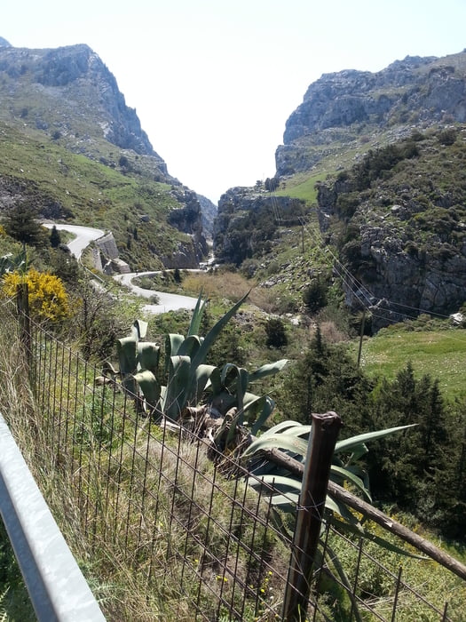
Ausfahrt von Agia Galini ins westliche Hügelland. Landschaftlch äußerst reizvoll. Schluchten und Aussichten ohne Ende.


Tour gallery

Tour map and elevation profile

  • Open Street Map
  • Google
Minimum height 23 m Maximum height 537 m Detailed view

More about the tour author

ultra
Member since 2010

Send private message

Comments

Gute Parkmöglichkeit am Hafen oder am Strand von Agia Galini.


GPS tracks

Trackpoints
  • GPX / Garmin Map Source (gpx) download
  • TCX / Garmin Training Center® (tcx) download
  • CRS / Garmin Training Center® (crs) download
  • Google Earth (kml) download
  • G7ToWin (g7t) download
  • TTQV (trk) download
  • Overlay (ovl) download
  • Fugawi (txt) download
  • Kompass (DAV) Track (tk) download
  • Track data sheet (pdf) download
  • Original file of the author (gpx) download

More about the tour author

ultra
Member since 2010

Send private message
Share track
Add to my favorites
Remove from my favorites
Edit tags
My score
Rate
Track: Ausfahrten rund um Agia Galini
Type: Road biking
Distance: 97,2 km
Evaluated on:
Duration:
Day(s)
Hour(s)
Minute(s)
Score: Landscape Fun factor Fitness Technique