


2 Tage auf der Fränkischen Saale
1. Etappe: Roth an der Saale bis Bad Kissingen Zeltplatz 22 km
2. Etappe: Bad Kissingen bis Langendorf 20 km
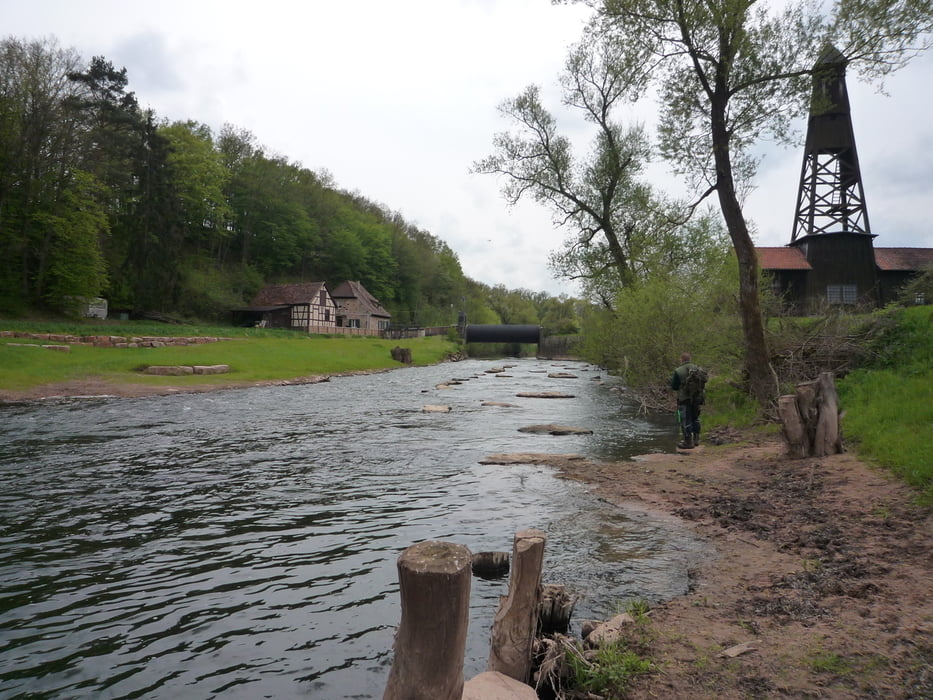
Die Landschaft ist traumhaft, ruhig, macht einfach Spaß! Der Wermutstropfen: etliche Wehr müssen überwunden werden, mit einem zweier Faltboot nicht gerade eine Sonntagstour. Auf der Etappe 1 sind bis zu 2 Meter Höhenunterschied zu bewältigen ( Bootswagen hilfreich! ). Trotz positiver Wasserstandsmeldung waren einige Abschnitte Grenzwertig! Kratzer am Boot lassen sich ( fast ) nicht vermeiden, Wasserschwelle mit etlichen Steinen und div. Flachwasserstellen müssen gemeistert werden. Wasserstände vorher abfragen!
Gefahren mir einem Klepper Aerius 2 im Mai 2015.
Viel Spaß!
Further information at
http://www.kajak-channel.de/bkvpegel.htmTour gallery
Tour map and elevation profile
Minimum height 142 m
Maximum height 208 m
More about the tour author
|
|
FLU |
Comments

GPS tracks
Trackpoints-
GPX / Garmin Map Source (gpx) download
-
TCX / Garmin Training Center® (tcx) download
-
CRS / Garmin Training Center® (crs) download
-
Google Earth (kml) download
-
G7ToWin (g7t) download
-
TTQV (trk) download
-
Overlay (ovl) download
-
Fugawi (txt) download
-
Kompass (DAV) Track (tk) download
-
Track data sheet (pdf) download
-
Original file of the author (gpx) download
More about the tour author
|
|
FLU |
Add to my favorites
Remove from my favorites
Edit tags
Open track
My score
Rate