


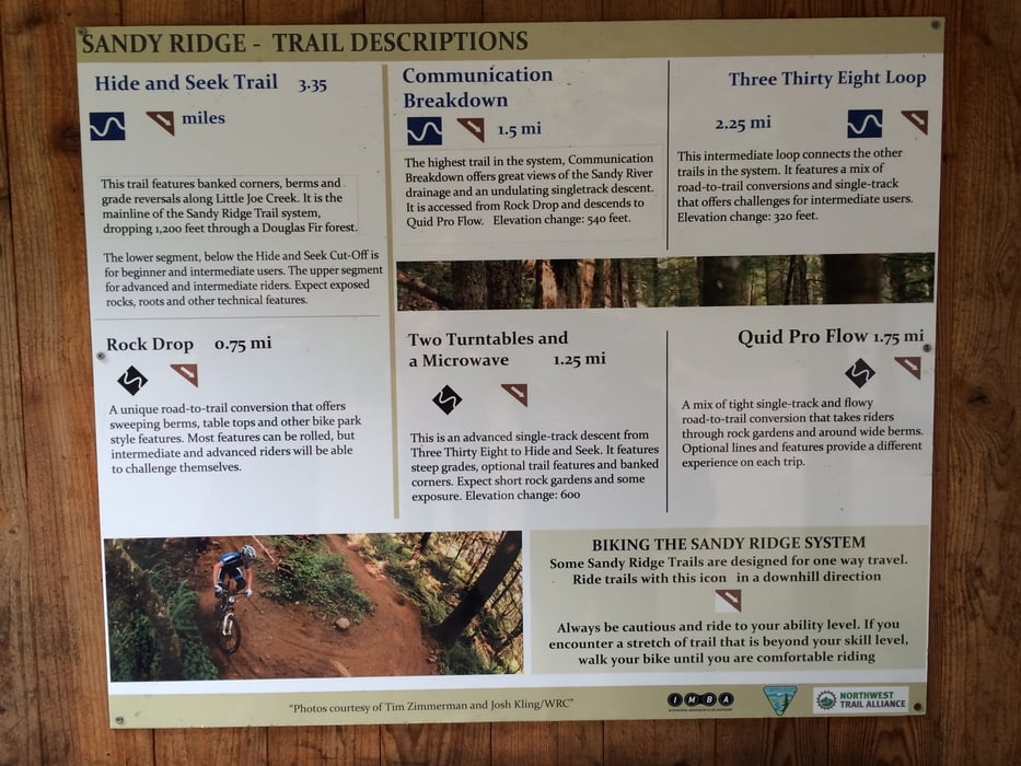
Vom Parkplatz fährt man eine gesperrte Teerstraße ca. 400 hm hinauf. Oben trifft man dann auf den Startpunkt. Von hier kann man mehrere Trail wieder nach unten fahren zum Parkplatz.
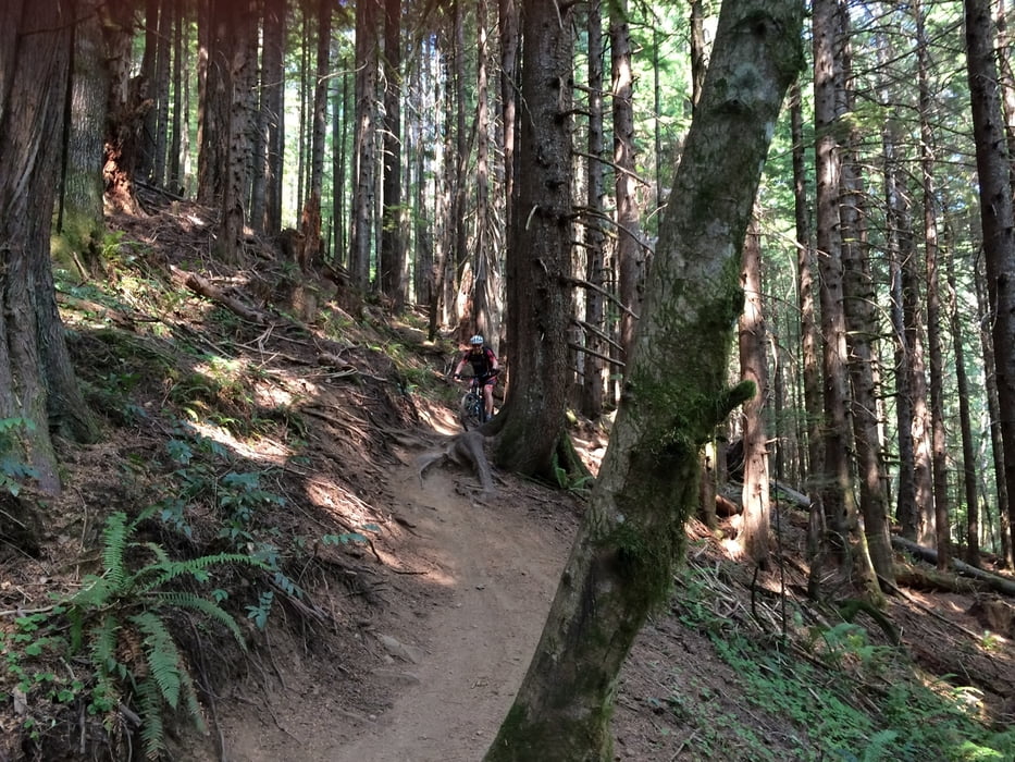
Die Trails sind mit viel Sorgfalt angelegt worden und es macht wirklich einen riesen Spaß. Bisher das tollste was ich gefunden habe. Wirklich genial.
Wer also zufällig in Portland/Oregon ist sollte es wirklich ausprobieren. MTBs kann man in der Stadt leihen.
Allen dann viel Spaß!
Further information at
http://www.mtbproject.com/trail/3482113Tour gallery
Tour map and elevation profile
Minimum height 292 m
Maximum height 663 m
More about the tour author
|
|
Cycling666 |
Comments

Mit dem Auto von Portland auf der 26 nach Osten Richtung Mount Hood. Durch das Örtchen Sandy durch und weiter auf der 26. Dann auf den East Sleepy Hollow Drive abbiegen und weiter auf den Parkplatz beim Sandy Ridge Trail Park. Abzweig ist auch auf der 26 gekennzeichnet.
GPS tracks
Trackpoints-
GPX / Garmin Map Source (gpx) download
-
TCX / Garmin Training Center® (tcx) download
-
CRS / Garmin Training Center® (crs) download
-
Google Earth (kml) download
-
G7ToWin (g7t) download
-
TTQV (trk) download
-
Overlay (ovl) download
-
Fugawi (txt) download
-
Kompass (DAV) Track (tk) download
-
Track data sheet (pdf) download
-
Original file of the author (gpx) download
More about the tour author
|
|
Cycling666 |
Add to my favorites
Remove from my favorites
Edit tags
Open track
My score
Rate