

Alpencross Teil 3
Von Imst das Inntal weiter bis Landeck. Hier haben wir uns entschlossen ins Paznauntal nach Imst zu fahren. Nach ein paar Irrungen sind wir nach See gekommen. Dort haben wir ein paar Höhenmeter mit der Seilbahn genommen, um nach Kappl abzufahren. Die nächste Übernachtung war im Hotel Victoria in Ischgl.
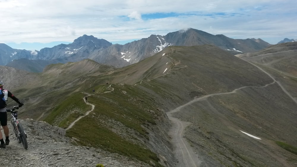
Wer in Ischgl übernachtet darf die Seilbahnen kostenfrei nutzen. Dies haben wir auch getan und sind bis zum höchsten Punkt, dem Idjoch gefahren. Hier fanden wir den Black Trail über die Gipfel. Dann ging es nach Samnaun und auf der alten Bergstraße bergab nach Martina. Wir folgten dem Inn nach Sur En und übernachteten in einer Hütte auf dem Campingplatz.
Weiter siehe Teil 4
Tour map and elevation profile
Minimum height 732 m
Maximum height 2864 m
More about the tour author

|
bernd_brinck |
Comments

GPS tracks
Trackpoints-
GPX / Garmin Map Source (gpx) download
-
TCX / Garmin Training Center® (tcx) download
-
CRS / Garmin Training Center® (crs) download
-
Google Earth (kml) download
-
G7ToWin (g7t) download
-
TTQV (trk) download
-
Overlay (ovl) download
-
Fugawi (txt) download
-
Kompass (DAV) Track (tk) download
-
Track data sheet (pdf) download
-
Original file of the author (gpx) download
More about the tour author
|
|
bernd_brinck |
Add to my favorites
Remove from my favorites
Edit tags
Open track
My score
Rate