Login

Forgot your login?

Cookies have to be accepted!
Your browser's cookie functionality is disabled. Please enable this functionality.

Not a member yet?

Register now
Login

Available for registred users only

Log in to use this feature.

Forgot your login?

Cookies have to be accepted!
Your browser's cookie functionality is disabled. Please enable this functionality.

Not a member yet?

Register now
Filter
Categories
Advanced filters
  • Distance (km)
  • Height
Save filters Reset filter

TrackRank

QRCode

Technical data

Distance18,6 km Height550 m Way down155 m Duration1 day 0 h Date25.08.2015
Scores Author Landscape Fun factor Fitness Technique

Statistics

200 Views Scores 17 Downloads Average
Rate
  • Track data sheet
  • Directions
  • Downloads

Erste Etappe auf den Hexenstieg von Osterode nach Polaterberg.

Die Strecke ist leicht bis mittel, fordert aber doch schon ein wenig Kondition.
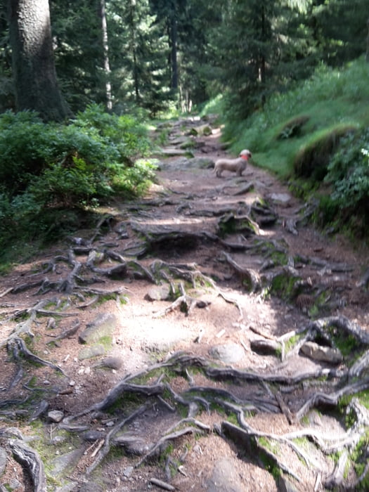
 

Tour gallery

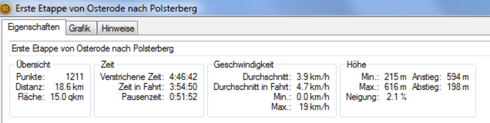
Tour map and elevation profile

  • Open Street Map
  • Google
Minimum height 215 m Maximum height 616 m Detailed view

More about the tour author

Nahtbarbe
Member since 2013

Send private message

Comments

Osterode Parkplatz Bleiche, gegenüber einstieg in den Hexenstieg


GPS tracks

Trackpoints
  • GPX / Garmin Map Source (gpx) download
  • TCX / Garmin Training Center® (tcx) download
  • CRS / Garmin Training Center® (crs) download
  • Google Earth (kml) download
  • G7ToWin (g7t) download
  • TTQV (trk) download
  • Overlay (ovl) download
  • Fugawi (txt) download
  • Kompass (DAV) Track (tk) download
  • Track data sheet (pdf) download
  • Original file of the author (gpx) download

More about the tour author

Nahtbarbe
Member since 2013

Send private message
Share track
Add to my favorites
Remove from my favorites
Edit tags
My score
Rate
Track: Hexenstieg in fünf Etappen hier erste die Etappe
Type: Hiking
Distance: 18,6 km
Evaluated on:
Duration:
Day(s)
Hour(s)
Minute(s)
Score: Landscape Fun factor Fitness Technique