


Start und Ziel in Vysocka Lipa
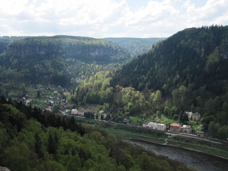
runter gehts nach Jetrichovice und durch die Klamm, über die Grundmühle. Dann übers Land bis nach Ruzova und Arnoltice bis vor zur Elbe. Hoch über dieser kann man sich wieder an Speis und Trank gütlich tun. Aber man sollte den Rückweg nicht aus den Augen verlieren. Im gemütlichen Auf und Ab geht es zurück nach Jetrichovice und von dort wieder bergan bis nach Vysocka Lipa.
Further information at
http://www.ceskosaske-svycarsko.cz/gemeinden/vysoka-lipa.htmlTour gallery
Tour map and elevation profile
Minimum height 208 m
Maximum height 426 m
More about the tour author
|
|
schwaran |
Comments

Bad Schandau, Schmilka, Grenze nach Tschechien, Hrensko, bei Edmundsklamm links halten und in Richtung Mezni Louka gehts nach Vysocka Lipa
GPS tracks
Trackpoints-
GPX / Garmin Map Source (gpx) download
-
TCX / Garmin Training Center® (tcx) download
-
CRS / Garmin Training Center® (crs) download
-
Google Earth (kml) download
-
G7ToWin (g7t) download
-
TTQV (trk) download
-
Overlay (ovl) download
-
Fugawi (txt) download
-
Kompass (DAV) Track (tk) download
-
Track data sheet (pdf) download
-
Original file of the author (gpx) download
More about the tour author
|
|
schwaran |
Add to my favorites
Remove from my favorites
Edit tags
Open track
My score
Rate