


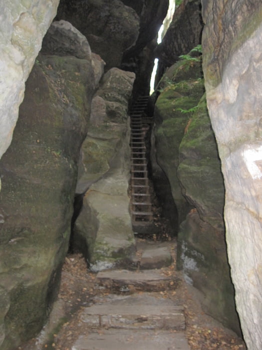
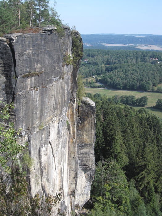
Vom Parkplatz in Pfaffendorf sind es nur ca. 500 m bis zum steilen Aufstieg auf den Pfaffenstein. Der Pfaffenstein u.a. mit der Barbarine gehört zu den Highlights der Sächsischen Schweiz südlich der Elbe. Auf dem Rückweg wird ein Abstecher zum Quirl eingeschlossen. Von dort hat man noch einmal Blick auf den Pfaffenstein.
Hinweis:
Man kann diese Tour auch unten von der Elbe in Königsstein starten. Königsstein ist mit der S-Bahn erreichbar. Da ein Urlaub in der Sächsischen Schweiz oft zu kurz ist, um alle Highlights abzuklappern, habe ich diese kurze Tour mit einer 2. kurzen Tour zum Bernhardstein und zum Labyrinth kombiniert. Diese startet nur 6 km entfernt in Leupoldishain.
Further information at
/en/tracks/detail.146175.htmlTour gallery
Tour map and elevation profile
Minimum height 305 m
Maximum height 348 m
More about the tour author
|
|
GPSDieter |
Comments

Für diese Kombitour empfiehlt es sich mit dem Auto anzureisen.
Die erste Tour beginnt in Pfaffendorf. Dort gibt es mehrere Parkplätzte.
GPS tracks
Trackpoints-
GPX / Garmin Map Source (gpx) download
-
TCX / Garmin Training Center® (tcx) download
-
CRS / Garmin Training Center® (crs) download
-
Google Earth (kml) download
-
G7ToWin (g7t) download
-
TTQV (trk) download
-
Overlay (ovl) download
-
Fugawi (txt) download
-
Kompass (DAV) Track (tk) download
-
Track data sheet (pdf) download
-
Original file of the author (gpx) download
More about the tour author
|
|
GPSDieter |
Add to my favorites
Remove from my favorites
Edit tags
Open track
My score
Rate