
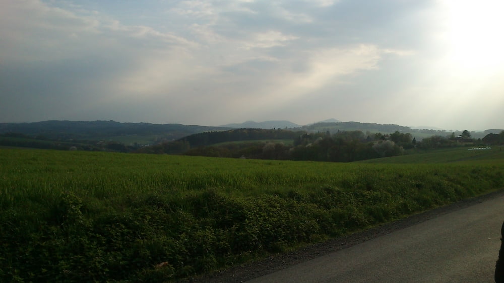

Eine der Touren die wir als "Berg - und Talfahrt" bezeichnen.
Immer wieder rauf und runter, den Ölberg des Siebengebirges immer im Blick macht diese Tour einfach Spaß.
Auch konditionell ein wenig anspruchsvoll, aber definitiv was fürs Auge.
Also, eine meiner Favoriten.
Rund um Bonn: Möchte jemand mitfahren ? E-MTB ausgewogen (kein Downhill, aber anstrengend darf es schon mal sein), immer den Spaß und die Natur im Vordergrund...eine Rast mit Kaltgetränk gehört auch dazu !
In der Woche bin ich mit einem Kollegen auf Tour, am We i.d.R. allein, da wäre ein/e Mitfahrer/in eine Bereicherung, denn geteilte Fahrfreude ist doppelte Freude !
Einfach Nachricht an mich in diesem Portal, ich freue mich !
Tour gallery
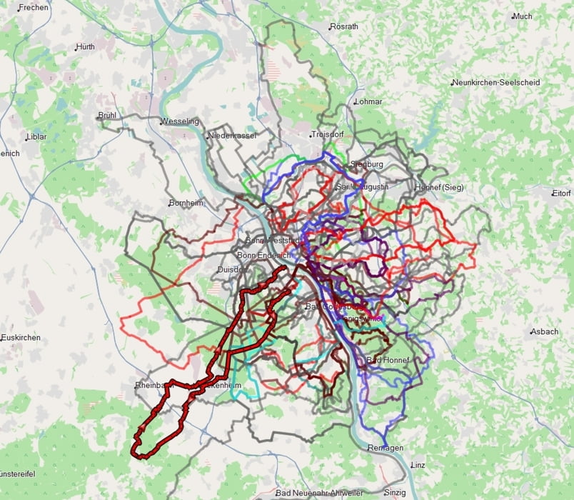
Tour map and elevation profile
Minimum height 74 m
Maximum height 211 m
More about the tour author
|
|
dssoft |
Comments

Sucht Euch den besten Startpunkt in Bonn aus....derer gibt es viele !
GPS tracks
Trackpoints-
GPX / Garmin Map Source (gpx) download
-
TCX / Garmin Training Center® (tcx) download
-
CRS / Garmin Training Center® (crs) download
-
Google Earth (kml) download
-
G7ToWin (g7t) download
-
TTQV (trk) download
-
Overlay (ovl) download
-
Fugawi (txt) download
-
Kompass (DAV) Track (tk) download
-
Track data sheet (pdf) download
-
Original file of the author (gpx) download
More about the tour author
|
|
dssoft |
Add to my favorites
Remove from my favorites
Edit tags
Open track
My score
Rate