


Am Morgen nahm ich meinen Lieblingsweg von Homburg Schwarzenbach nach Kirkel Neuhäusel.
Am Abend fuhr ich zuerst durch das Kirkeler Tal nach Lautzkirchen . Ich bog allerdings bald nach links den Berg hoch ab und fand mich in Richtung Ortsausgang auf einem supersteilen Weg der richtig in die Beine gieng. Als ich den Rücken erreicht hatte fuhr ich auf diesem nach Norden um dann das Taubental hinauszuradeln und über Beeden zum Ausgangspunkt zurückzukehren.
Further information at
https://de.wikipedia.org/wiki/BliesgauTour gallery
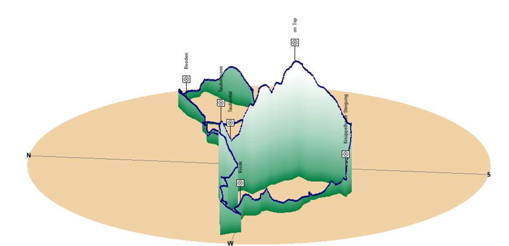
Tour map and elevation profile
Minimum height 226 m
Maximum height 383 m
More about the tour author
|
|
Pheinz |
Comments

Start und Ziel in Homburg Schwarzenbach.
GPS tracks
Trackpoints-
GPX / Garmin Map Source (gpx) download
-
TCX / Garmin Training Center® (tcx) download
-
CRS / Garmin Training Center® (crs) download
-
Google Earth (kml) download
-
G7ToWin (g7t) download
-
TTQV (trk) download
-
Overlay (ovl) download
-
Fugawi (txt) download
-
Kompass (DAV) Track (tk) download
-
Track data sheet (pdf) download
-
Original file of the author (gpx) download
More about the tour author
|
|
Pheinz |
Add to my favorites
Remove from my favorites
Edit tags
Open track
My score
Rate