
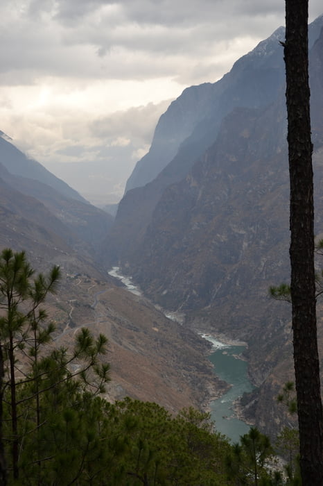

Wanderung von Qiaotou bis Tina´s Guesthouse (GH) oberhalb der MiddleTigerLeapingGorge.
Note: Es wird im Moment (03/2016) viel gebaut und der alte HighTrail im vorderen Bereich wird oder ist evtl. einer neuen Strasse gewichen. Ein ausgeschildeter neuer Weg zieht dort jetzt schon steil hoch und mündet in der nächsten Ortschaft mit dem alten HighTrail wieder zusammen. Der neue Weg kostet aber 1h Extra.
Die 8h sind nur bei flottem Tempo (in 2000m Höhe!) zu machen. Wanderausrüstung (Schuhe) und Trittsicherheit erforderlich.
Von Tinas´s auf der Strasse 20min zu Walnut Garden (Sean´s GH, Tibet GH). Auf dem High Trail 2h nach Wegweiser (zieht nochmal Schleife, aber 2h ist kaum zu glauben, müsste auch in 1h gehen)
Tip: Der Beste weg zu Sean o. Tibet GH im Walnut Garden oder von Walnut Garden (village) zur MTLG ist durch die Schlucht am Fluss entlang (ca. 1h). Ab/Aufstieg zur MTGL von Tina´s ca. 45min
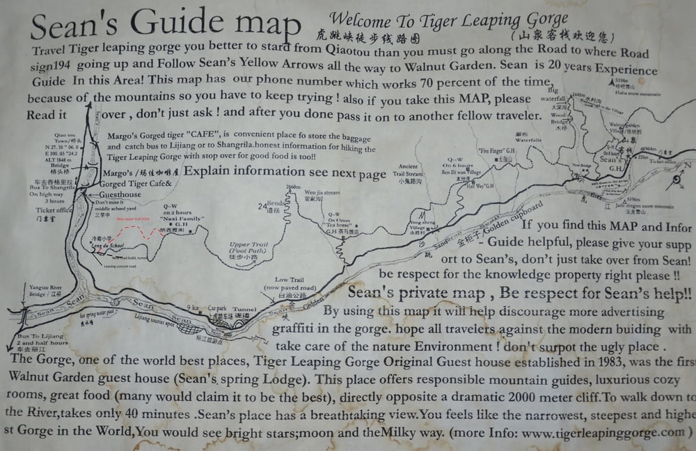
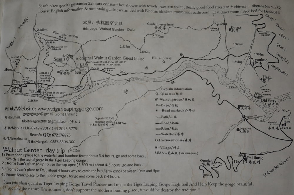
Ich habe noch 2 Shots von alten Karten von Sean´s GH im Walnut Garden anghängt. Den neuen Trail habe ich angedeutet . Give Sean some respect!
Further information at
http://www.geo.de/reisen/community/reisebericht/733012/1/Dali-Lijiang-ShangriLa-YunnanTour gallery
Tour map and elevation profile
Minimum height 1876 m
Maximum height 2668 m
More about the tour author

|
Stefan_L_01 |
Comments

GPS tracks
Trackpoints-
GPX / Garmin Map Source (gpx) download
-
TCX / Garmin Training Center® (tcx) download
-
CRS / Garmin Training Center® (crs) download
-
Google Earth (kml) download
-
G7ToWin (g7t) download
-
TTQV (trk) download
-
Overlay (ovl) download
-
Fugawi (txt) download
-
Kompass (DAV) Track (tk) download
-
Track data sheet (pdf) download
-
Original file of the author (gpx) download
More about the tour author
|
|
Stefan_L_01 |
Add to my favorites
Remove from my favorites
Edit tags
Open track
My score
Rate