


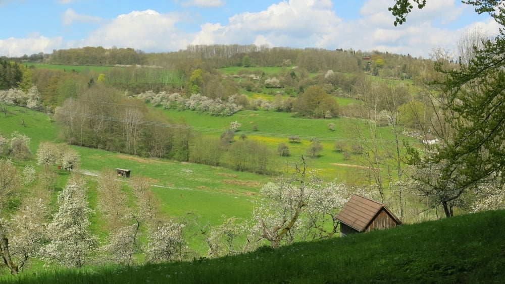
Vom Parkplatz zurück zur Straße, schräg nach links durch den Wald mit Rotstrich, über den Rücken des Hetzles (zunächst Gelbpunkt), dann ohne Markierung links ab und dann rechts nach Gleisenhof. Nach Linkskurve im Ort rechts ab (Anlieger), an Wochenendgrundstücken vorbei auf Wiese. Nach links geradeaus kurz ktäftig abwärts zur Straße. An Pferdekoppel vorbei, am Reiterhof rechts und bald auf Fahrweg kräftig bergan am Waldrand auf die Höhe. Oben an Infotafel rechts, rechts haltend an Wurzhütte vorbei auf Waldweg zum Parkplatz zurück.
HINWEIS zum Video:
Mit Mozilla Firefox und Flash- Player Plugin startet das Video direkt.
Andernfalls verwendet ihr in eurem Browser den Link:
https://www.google.de/#q=EUMR2TLZV2w
Tour gallery


Tour map and elevation profile
Minimum height 398 m
Maximum height 533 m
More about the tour author
|
|
heinz-57 |
Comments

Von Neunkirchen am Brand kommend Richtung Rödlas/ Ermreuth. Am Scheitelpunkt der Auffahrt rechts 100m zu Wanderparkplatz.
GPS tracks
Trackpoints-
GPX / Garmin Map Source (gpx) download
-
TCX / Garmin Training Center® (tcx) download
-
CRS / Garmin Training Center® (crs) download
-
Google Earth (kml) download
-
G7ToWin (g7t) download
-
TTQV (trk) download
-
Overlay (ovl) download
-
Fugawi (txt) download
-
Kompass (DAV) Track (tk) download
-
Track data sheet (pdf) download
-
Original file of the author (gpx) download
More about the tour author
|
|
heinz-57 |
Add to my favorites
Remove from my favorites
Edit tags
Open track
My score
Rate