Login

Forgot your login?

Cookies have to be accepted!
Your browser's cookie functionality is disabled. Please enable this functionality.

Not a member yet?

Register now
Login

Available for registred users only

Log in to use this feature.

Forgot your login?

Cookies have to be accepted!
Your browser's cookie functionality is disabled. Please enable this functionality.

Not a member yet?

Register now
Filter
Categories
Advanced filters
  • Distance (km)
  • Height
Save filters Reset filter

TrackRank

QRCode

Technical data

Distance122,3 km Height811 m Way down802 m Duration04:30 h:m Date26.06.2016
Scores Author Landscape Fun factor Fitness Technique

Statistics

932 Views Scores 116 Downloads Average
Rate
  • Track data sheet
  • Directions
  • Downloads

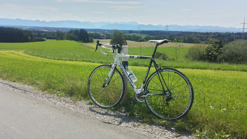
Super Runde um den Starnberger See und den Osterseen auf ruhigen teils einsamen Straßen. Im Sommer bietet sich eine Pause am Alten Weiher an (bei 75 km) um kurz ins Wasser zu springen und am Kiosk für Nachschub zu sorgen. Der Rückweg geht dann durchs Isartal.

Diese Runde zählt definitiv zu einer meiner Lieblingsrunden. Euch wünsche natürlich auch viel Spaß bei der Tour!


Für alle Nichtmünchner oder wer einfach eine kürzere Tour sucht habe ich ein 95 km Variante mit Start in Neufahrn eingestellt (Tour #157205)

Further information at

/en/tracks/detail.157205.html

Tour map and elevation profile

  • Open Street Map
  • Google
Minimum height 470 m Maximum height 684 m Detailed view

More about the tour author

stefanlos
Member since 2008

Send private message

Comments

Zur Anfahrt gibt's wohl nicht viel zu sagen weil ja jeder seinen individuellen Weg innerhalb der Stadt hat.

Falls einer mit dem Auto anreist kann er beim Heizkraftwerk ohne Parkschein parken

GPS tracks

Trackpoints
  • GPX / Garmin Map Source (gpx) download
  • TCX / Garmin Training Center® (tcx) download
  • CRS / Garmin Training Center® (crs) download
  • Google Earth (kml) download
  • G7ToWin (g7t) download
  • TTQV (trk) download
  • Overlay (ovl) download
  • Fugawi (txt) download
  • Kompass (DAV) Track (tk) download
  • Track data sheet (pdf) download
  • Original file of the author (gpx) download

More about the tour author

stefanlos
Member since 2008

Send private message
Share track
Add to my favorites
Remove from my favorites
Edit tags
My score
Rate
Track: Von München um die Osterseen
Type: Road biking
Distance: 122,3 km
Evaluated on:
Duration:
Day(s)
Hour(s)
Minute(s)
Score: Landscape Fun factor Fitness Technique