


Von Heimbach bis Gemünd durch das Oleftal zur Oleftalsperre und über Simmerath nach Langerwehe.
Ausgangspunkt dieser Punkt-zu-Punkt-Fahrt ist der Bahnhof Langerwehe. Mit der Euregiobahn fahre ich bis Düren und steige um in die Rurtalbahn. Diese befördert mich bis Heimbach, wo ich dann die eigentliche Mountainbike-Tour starte.
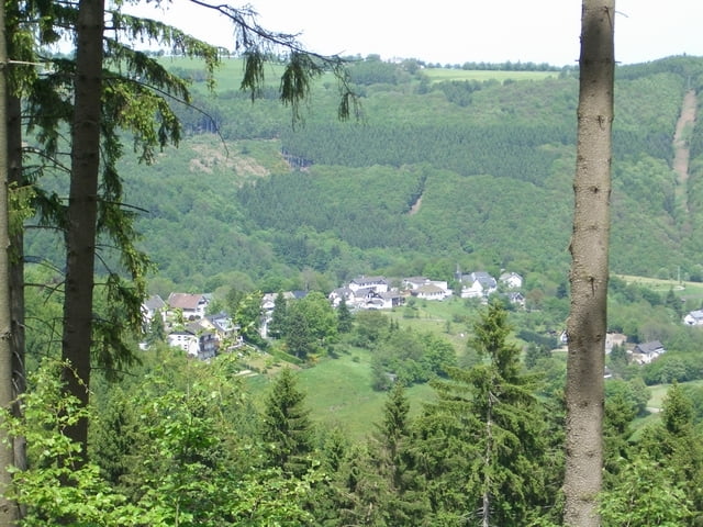
Bei dieser "Höhentour" wird Wert auf Panorama und schöne Aussichten gelegt! Der Singletrailanteil ist bezogen auf "Oil of Olef - Trails" geringer.
mehr auf: www.xcracer.de/stre05_oil_of_olef.htm
Ausgangspunkt dieser Punkt-zu-Punkt-Fahrt ist der Bahnhof Langerwehe. Mit der Euregiobahn fahre ich bis Düren und steige um in die Rurtalbahn. Diese befördert mich bis Heimbach, wo ich dann die eigentliche Mountainbike-Tour starte.
Bei dieser "Höhentour" wird Wert auf Panorama und schöne Aussichten gelegt! Der Singletrailanteil ist bezogen auf "Oil of Olef - Trails" geringer.
mehr auf: www.xcracer.de/stre05_oil_of_olef.htm
Further information at
http://www.xcracer.de/stre05_oil_of_olef.htmTour gallery
Tour map and elevation profile
Minimum height 140 m
Maximum height 628 m
More about the tour author

|
XCRacer |
Comments

A4 - Abfahrt Langerwehe
Ausschilderung Langerwehe - Bahnhof
Ausschilderung Langerwehe - Bahnhof
GPS tracks
Trackpoints-
GPX / Garmin Map Source (gpx) download
-
TCX / Garmin Training Center® (tcx) download
-
CRS / Garmin Training Center® (crs) download
-
Google Earth (kml) download
-
G7ToWin (g7t) download
-
TTQV (trk) download
-
Overlay (ovl) download
-
Fugawi (txt) download
-
Kompass (DAV) Track (tk) download
-
Track data sheet (pdf) download
-
Original file of the author (g7t) download
More about the tour author
|
|
XCRacer |
Add to my favorites
Remove from my favorites
Edit tags
Open track
My score
Rate