
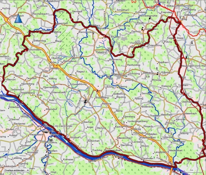

Startpunkt ist in Tittling am Bahnhof ( Es kann aber auch die längere Variante gewählt werden und von Kalteneck abgefahren werden ). An geteerten Radwegen fahren wir bis Außernzell, dort biegen wir links ab Richtung Ohetal Radweg. Durch ein schönes Stück Wald radeln wir auf fast ebener Strecke Richtung Donau und biegen dann wieder links ab zum Donauradweg.
An der Donau entlang gibt es ein paar Einkehrmöglichkeiten. An der Gaissa biegen wir links ab Richtung Fatting und fahren parallel zur B85 zurück nach tittling
Alle Wege sind gut ausgeschildert. Die Tour kann man auch mit MTB o. Crossbike fahren.
Tour gallery


Tour map and elevation profile
Minimum height 300 m
Maximum height 540 m
More about the tour author
|
|
franz1962 |
Comments

GPS tracks
Trackpoints-
GPX / Garmin Map Source (gpx) download
-
TCX / Garmin Training Center® (tcx) download
-
CRS / Garmin Training Center® (crs) download
-
Google Earth (kml) download
-
G7ToWin (g7t) download
-
TTQV (trk) download
-
Overlay (ovl) download
-
Fugawi (txt) download
-
Kompass (DAV) Track (tk) download
-
Track data sheet (pdf) download
-
Original file of the author (gpx) download
More about the tour author
|
|
franz1962 |
Add to my favorites
Remove from my favorites
Edit tags
Open track
My score
Rate