


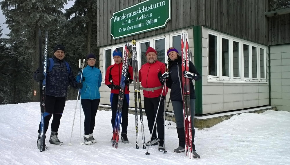
Na dnešní den předpověď slibovala více světla, ale byli jsme příliš nízko (viz jedna z foto), abychom si slunce užili.
Jinak ale parádní den na běžkách, stopa zmrzlá s novým popraškem, odpoledne mírně měkčí, ale pořád se dalo.
Běžky jedooou!
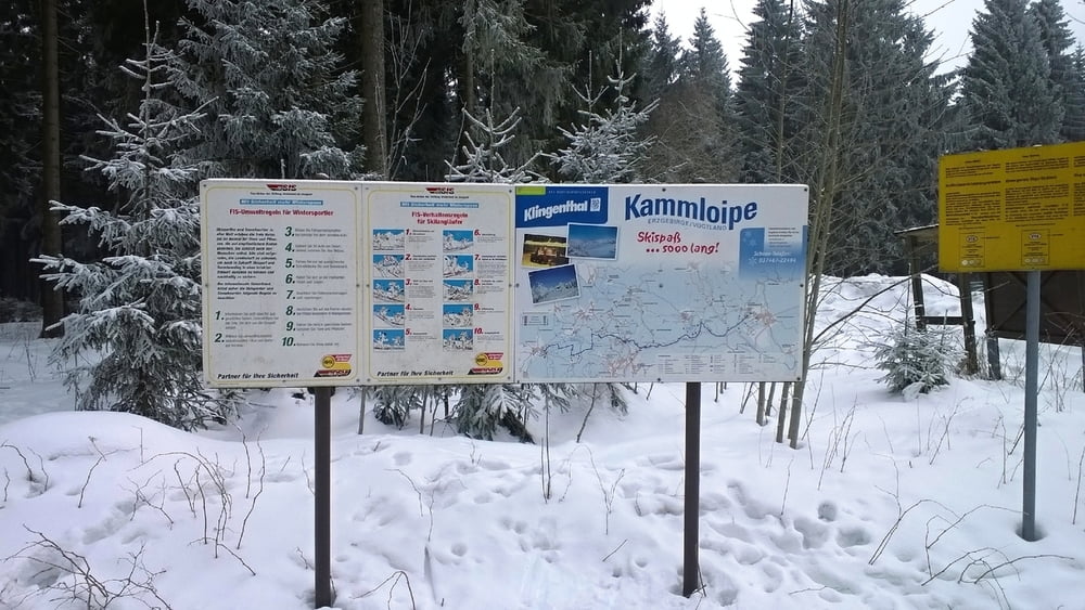
Na foto se podíváte, když kliknete na odkaz níže.
Jinak ale parádní den na běžkách, stopa zmrzlá s novým popraškem, odpoledne mírně měkčí, ale pořád se dalo.
Běžky jedooou!
Na foto se podíváte, když kliknete na odkaz níže.
Further information at
http://stanpilot.rajce.idnes.cz/bezky_2017-02-11_Kottenheide-Schneckenstein-Muhlleithen-Aschberg-KottenheideTour gallery
Tour map and elevation profile
Minimum height 744 m
Maximum height 934 m
More about the tour author
|
|
stan - pilot |
Comments

Do Aše se můžete dopravit třeba autem, na motorce, ale i na kole po silnici č. 64 z Chebu přes Hazlov. Tato silnice vás nakonec dovede až na hraniční přechod Aš - Asch / Selb.
Můžete přijet také přes hraniční přechod Doubrava - Bad Elster. Nebo můžete použít k dopravě vlak, který jede ze stanice Cheb.
V Aši se můžete také ubytovat, a pak na kolech vyrážet na podobné pohodové výlety po blízké či vzdálenějším okolí, tak jako to děláme my z nakole.assko.cz
Novinkou, a tak trochu reminiscencí dob minulých, je přímé vlakové spojení Aš - Selb.
Do Kottenheide, které leží hned vedle silnice S301 mezi městy Zwota a Schöneck, se dá pohodlně dojet osobním autem.
GPS tracks
Trackpoints-
GPX / Garmin Map Source (gpx) download
-
TCX / Garmin Training Center® (tcx) download
-
CRS / Garmin Training Center® (crs) download
-
Google Earth (kml) download
-
G7ToWin (g7t) download
-
TTQV (trk) download
-
Overlay (ovl) download
-
Fugawi (txt) download
-
Kompass (DAV) Track (tk) download
-
Track data sheet (pdf) download
-
Original file of the author (gpx) download
More about the tour author
|
|
stan - pilot |
Add to my favorites
Remove from my favorites
Edit tags
Open track
My score
Rate