


Wir sind eine Woche auf Öland. Unser Standort ist Wikegård Camping. Wir haben dort eine Hütte gemietet. Die Touren unternehmen wir entweder direkt von dort oder wir fahren ein paar KM mit dem Auto.
Heute sind wir mit dem Auto nach Sörby gefahren um eine Tour weiter südlich zu machen. Es geht in erster Linie auf kleinen Straßen entlang ohne viel Autoverkehr. Beeindruckt haben uns die Eisdiele in Färjestaden :-); Odins flisor und Karum Alvar und Noas Ark.
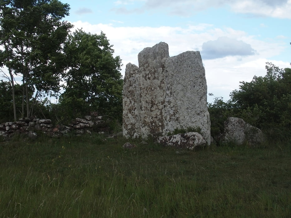
Odins flisor ist ein flacher fast quadratischer senkrechter Stein mit 2,5 Meter Kandenlänge, der einen Spalt hat. Dort soll Odin sein Schwert hineingestoßen und sein Pferd angebunden haben. Es ist trotzdem abgehauen.
In Karum Alvar sind sehr gut zu sehende Steinsetzungen und das Alvar ist auch sehr typisch, wenn auch nicht so groß, wie das Stora Alvaret noch weiter südlich.
Further information at
https://www.oland.se/deTour gallery
Tour map and elevation profile
Minimum height -10 m
Maximum height 53 m
More about the tour author

|
smartandem |
Comments

Wir fahren immer von München über die A9 bis zum Berliner Ring und dann A24 und A20 bis nach Rostock. Von dort mit der Fähre nach Trelleborg. Diesen Weg haben wir nur auf dem Rückweg genutzt.
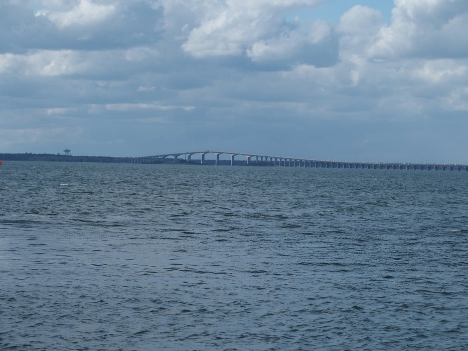
Diesmal kamen wir jedoch vom Tandemtreffen in Neuwied und sind nach Travemünde gefahren. Vorn dort mit der Fähre nach Malmö. Von dort über Båstad (haben dort was erledigt) nach Melbystrand. Von dort führt die 24er Straße nach Kalmar. Über die Brücke und schon ist man in Öland.
GPS tracks
Trackpoints-
GPX / Garmin Map Source (gpx) download
-
TCX / Garmin Training Center® (tcx) download
-
CRS / Garmin Training Center® (crs) download
-
Google Earth (kml) download
-
G7ToWin (g7t) download
-
TTQV (trk) download
-
Overlay (ovl) download
-
Fugawi (txt) download
-
Kompass (DAV) Track (tk) download
-
Track data sheet (pdf) download
-
Original file of the author (gpx) download
More about the tour author
|
|
smartandem |
Add to my favorites
Remove from my favorites
Edit tags
Open track
My score
Rate