


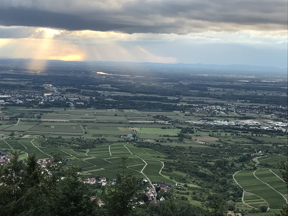
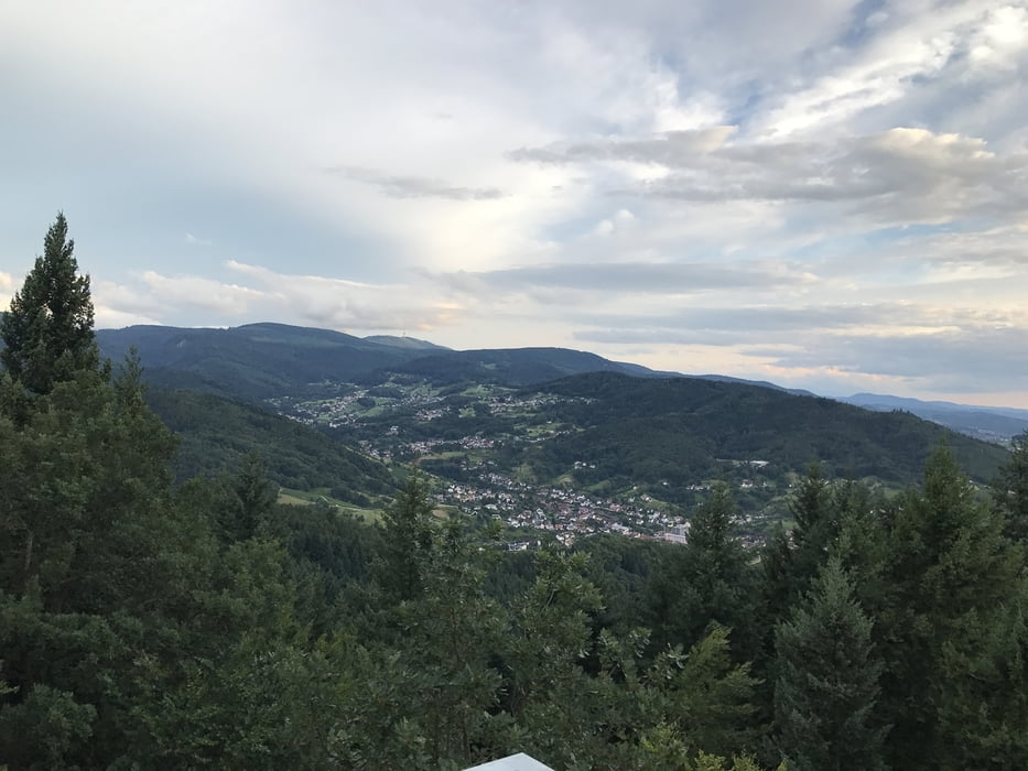
In Lauf bei dem Rathaus gestartet sind wir über den Ortsteil Aspich Richtung Neusatz gefahren. Über den Heuberg bis zur Kirche in Neusatz und dann Richtung Neusatzeck. Von hieraus sind wir zur Burg Neu-Windeck rüber gefahren in Richtung Bühlertal. Über den Kössler sind wir dann über die Grillhütte am Schartenberg durch die Reben in den Holzmattweg gefahren. Hier ist ein schöner Trail hoch zum Parkplatz Bildeiche. Dann sind wir den Trail hoch zum Aussichtspunkt Schartenberghütte. Ein herrlicher Blick über Bühlertal zur Hornisgrinde und in die Rheinebene. Auf dem Weg abwärts haben wir einen neuen Trail gefunden und sind dann über die Reben in Altschweier wieder Richtung Lauf aufgebrochen. Tolle und anspruchsvolle Tour.
Tour gallery
Tour map and elevation profile
Minimum height 143 m
Maximum height 509 m
More about the tour author
|
|
kaefermountainbike |
Comments

Gestartet sind wir in 77886 Lauf beim Rathaus. Parkplätze sind genügend vorhanden. Hier ist auch im Juli und August immer Dienstags ab 18 Uhr Dorfhock. Idealer Abschluß nach einer tollen Ausfahrt.
GPS tracks
Trackpoints-
GPX / Garmin Map Source (gpx) download
-
TCX / Garmin Training Center® (tcx) download
-
CRS / Garmin Training Center® (crs) download
-
Google Earth (kml) download
-
G7ToWin (g7t) download
-
TTQV (trk) download
-
Overlay (ovl) download
-
Fugawi (txt) download
-
Kompass (DAV) Track (tk) download
-
Track data sheet (pdf) download
-
Original file of the author (gpx) download
More about the tour author
|
|
kaefermountainbike |
Add to my favorites
Remove from my favorites
Edit tags
Open track
My score
Rate