


Von Glottertal über Denzlingen, Waldkirch Gutach im Elztal durchs Simonswälder-Tal auf
verkehrsarmem, meist schattigen Weg durchs
Hexenloch hinauf zur Kalten Herberge. Man durchfährt
ein ruhiges, romantisches Schwarzwaldtal und kommt
an typischen, einsamen Schwarzwaldhöfen und an der
Hexenlochmühle vorbei. Der eigentliche Aufstieg ab
Simonswald ist ca. 25 km lang und dadurch auch
ziemlich moderat ( durchschn. 6%, max 8-9%). Nach
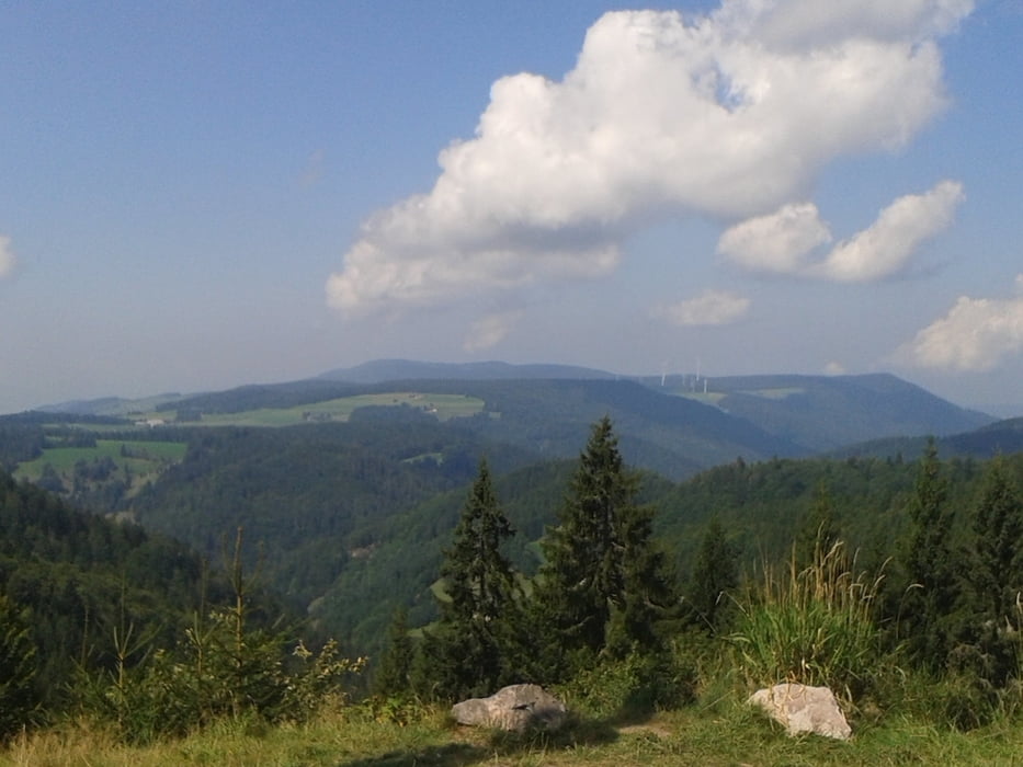
"Kalte Herberge" folgt eine aussichtsreiche Panorama-
Strecke über die Höhen des Hochschwarzwaldes.
ÜberSt. Märgen und St. Peter gehts in rasanter Fahrt wieder
zurück ins Tal.
Bis St. Peter sind es ca. 1000 hm. Wer noch Zeit und Kraft hat, der macht noch den Abstecher zum Kandel.
Anmerkung:
Die Strecke von Glottertal bis Gutach ist ideal zum einradeln, hat aber nichts von der folgenden Talidylle ab Obersimonswald.
Tour gallery
Tour map and elevation profile
Minimum height 248 m
Maximum height 1182 m
More about the tour author
|
|
Digger67 |
Comments

GPS tracks
Trackpoints-
GPX / Garmin Map Source (gpx) download
-
TCX / Garmin Training Center® (tcx) download
-
CRS / Garmin Training Center® (crs) download
-
Google Earth (kml) download
-
G7ToWin (g7t) download
-
TTQV (trk) download
-
Overlay (ovl) download
-
Fugawi (txt) download
-
Kompass (DAV) Track (tk) download
-
Track data sheet (pdf) download
-
Original file of the author (gpx) download
More about the tour author
|
|
Digger67 |
Add to my favorites
Remove from my favorites
Edit tags
Open track
My score
Rate