


Arnoldstein-Dreiländereck (Pec, Ofen Monte Forno)-
Krankja Gora-Mojstrana-Pokljuka-Koca da Ukovnici-
Bohinskja Jezero
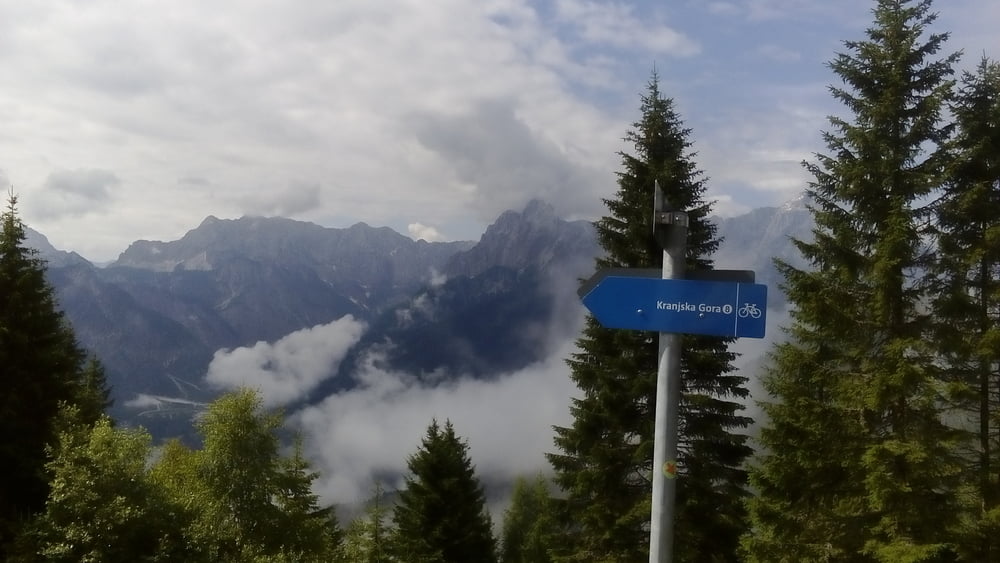
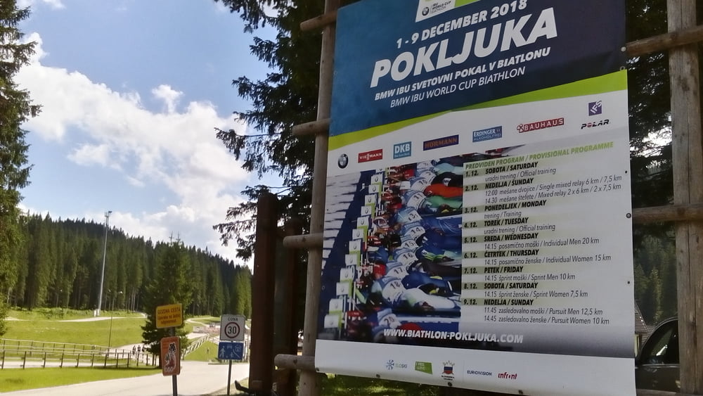
Nach dem Waldwegerl Einstieg geht’s unspektakulär weiter auf Schotterstraße. Kurz vorm Dreiländereck zwingt mich eine Wegsperre auf die Schipiste, 15' Schiebung. Schöner Ausblick in die drei Länder! Hinunter wieder Schotter. In Kranskja Gora ist auch im Sommer einiges los. Auf dem Radweg flussabwärts flott Meter gemacht. Dann stehen die nächsten 1000hm an, wieder schottrig tw a bissl tief. Der höchste Punkt des Tages hat auf meiner Karte keinen Namen (1510m), ist im Wald und daher auch keine Aussicht. Hinunter führt der Weg dankenswerterweise am Biathlonzentrum Pokljuka vorbei, wo auch sommers fleißig trainiert wird. Quartier, Pension Rosic, in der Nähe vom See gefunden. Geht so. NF 43€. Zimmer zur gut frequentierten Straße…
Nach dem Waldwegerl Einstieg geht’s unspektakulär weiter auf Schotterstraße. Kurz vorm Dreiländereck zwingt mich eine Wegsperre auf die Schipiste, 15' Schiebung. Schöner Ausblick in die drei Länder! Hinunter wieder Schotter. In Kranskja Gora ist auch im Sommer einiges los. Auf dem Radweg flussabwärts flott Meter gemacht. Dann stehen die nächsten 1000hm an, wieder schottrig tw a bissl tief. Der höchste Punkt des Tages hat auf meiner Karte keinen Namen (1510m), ist im Wald und daher auch keine Aussicht. Hinunter führt der Weg dankenswerterweise am Biathlonzentrum Pokljuka vorbei, wo auch sommers fleißig trainiert wird. Quartier, Pension Rosic, in der Nähe vom See gefunden. Geht so. NF 43€. Zimmer zur gut frequentierten Straße…
Tour gallery
Tour map and elevation profile
Minimum height 579 m
Maximum height 1513 m
More about the tour author
|
|
mitter |
Comments

Start in Arnoldstein beim Gasthof Wallner.
GPS tracks
Trackpoints-
GPX / Garmin Map Source (gpx) download
-
TCX / Garmin Training Center® (tcx) download
-
CRS / Garmin Training Center® (crs) download
-
Google Earth (kml) download
-
G7ToWin (g7t) download
-
TTQV (trk) download
-
Overlay (ovl) download
-
Fugawi (txt) download
-
Kompass (DAV) Track (tk) download
-
Track data sheet (pdf) download
-
Original file of the author (gpx) download
More about the tour author
|
|
mitter |
Add to my favorites
Remove from my favorites
Edit tags
Open track
My score
Rate