Login

Forgot your login?

Cookies have to be accepted!
Your browser's cookie functionality is disabled. Please enable this functionality.

Not a member yet?

Register now
Login

Available for registred users only

Log in to use this feature.

Forgot your login?

Cookies have to be accepted!
Your browser's cookie functionality is disabled. Please enable this functionality.

Not a member yet?

Register now
Filter
Categories
Advanced filters
  • Distance (km)
  • Height
Save filters Reset filter

TrackRank

QRCode

Technical data

Distance9,1 km Height420 m Way down427 m Duration05:00 h:m Date22.09.2018
Scores Author Landscape Fun factor Fitness Technique

Statistics

158 Views Scores 18 Downloads Average
Rate
  • Track data sheet
  • Directions
  • Downloads
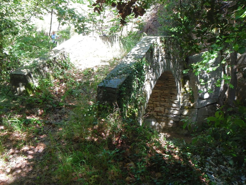
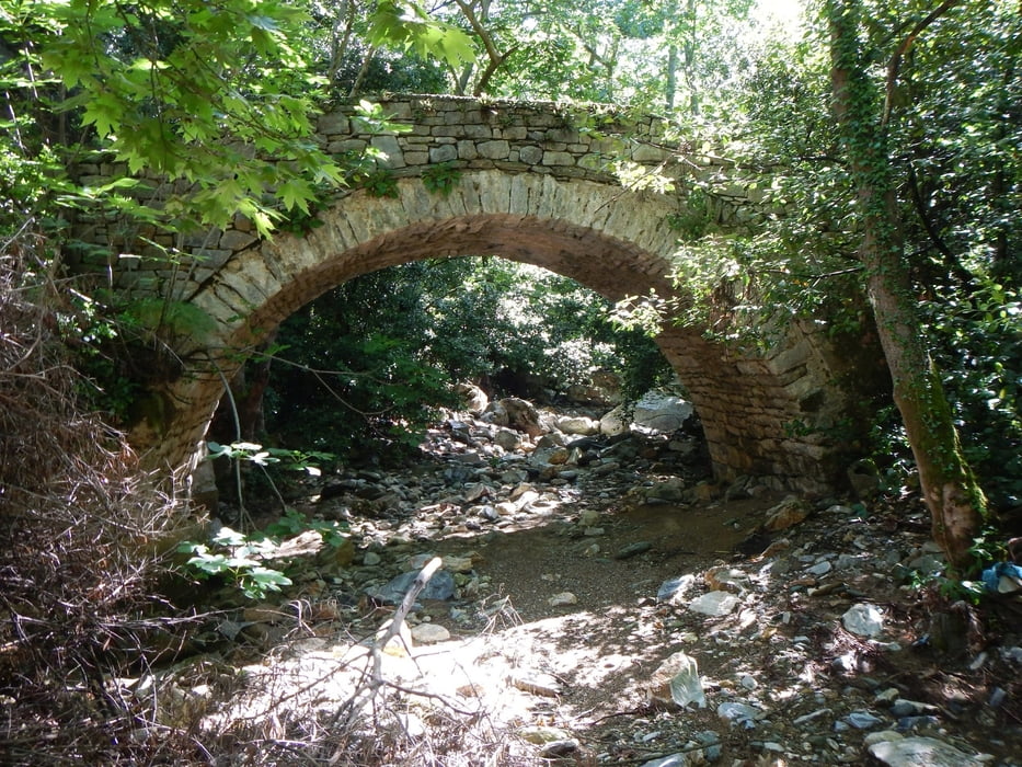
From Kala Nera up to Milies, you go near the river to the stone bridge Tsipokalamos. From there you go up the hill to the main square.
The way back is most of the time in the olive trees.

Tour gallery

Tour map and elevation profile

  • Open Street Map
  • Google
Minimum height 17 m Maximum height 414 m Detailed view

More about the tour author

Mapdekode
Member since 2008

Send private message

Comments

GPS tracks

Trackpoints
  • GPX / Garmin Map Source (gpx) download
  • TCX / Garmin Training Center® (tcx) download
  • CRS / Garmin Training Center® (crs) download
  • Google Earth (kml) download
  • G7ToWin (g7t) download
  • TTQV (trk) download
  • Overlay (ovl) download
  • Fugawi (txt) download
  • Kompass (DAV) Track (tk) download
  • Track data sheet (pdf) download
  • Original file of the author (gpx) download

More about the tour author

Mapdekode
Member since 2008

Send private message
Share track
Add to my favorites
Remove from my favorites
Edit tags
My score
Rate
Track: Greece, Magnisia, Kala Nera - Milies
Type: Hiking
Distance: 9,1 km
Evaluated on:
Duration:
Day(s)
Hour(s)
Minute(s)
Score: Landscape Fun factor Fitness Technique