
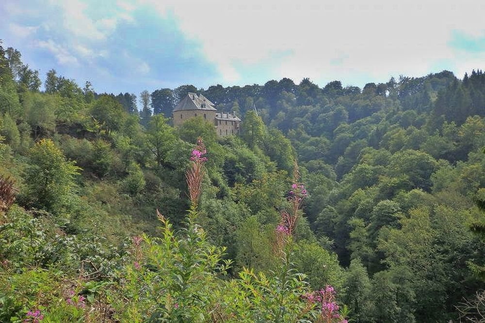

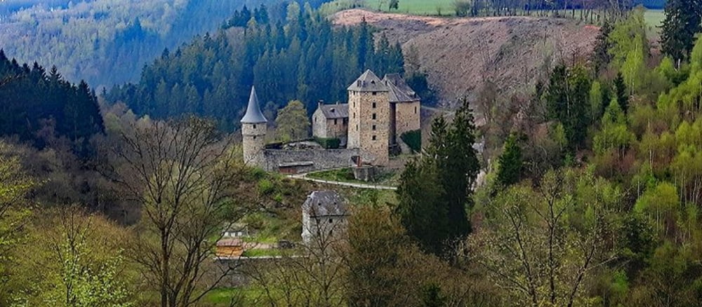
Die Wanderung führt von Burg Reinhardstein zum Bayehon-Wasserfall
 13,00 km
Es geht durch eine wildromantische Landschaft. Gutes Schuhwerk und Trittsicherheit sind ein Muss.*)
Unsere Wanderung heute beginnt an der Burg Reinhardstein in Ostbelgien. Gutes Schuhwerk und Trittsicherheit sind bei dieser Wanderung ein Muss. Es geht über Forstwege, aber zum großen Teil auch über morastige, steinige und mit Baum-wurzeln durchzogene schmale Pfade. Diese Wanderung kann übrigens auch unternommen werden, wenn irgend-wann wieder die roten Flaggen im Hohen Venn gehisst sind.
Further information at
http://der-eifelyeti.de/2019/02/05/ein-abenteuer-im-warchetal/Tour gallery
Tour map and elevation profile
Minimum height 430 m
Maximum height 606 m
More about the tour author
|
|
Eifelyeti |
Comments

GPS tracks
Trackpoints-
GPX / Garmin Map Source (gpx) download
-
TCX / Garmin Training Center® (tcx) download
-
CRS / Garmin Training Center® (crs) download
-
Google Earth (kml) download
-
G7ToWin (g7t) download
-
TTQV (trk) download
-
Overlay (ovl) download
-
Fugawi (txt) download
-
Kompass (DAV) Track (tk) download
-
Track data sheet (pdf) download
-
Original file of the author (gpx) download
More about the tour author
|
|
Eifelyeti |
Add to my favorites
Remove from my favorites
Edit tags
Open track
My score
Rate