


Für diese Wanderung wird eine Genehmigung benötigt! Die kostet zwar nichts aber damit soll die Anzahl an Personen pro Tag begrenzt werden. Deshalb gibt es pro Tag nur ein begrenztes Kontingent. Wer dennoch Wandert und erwischt wird dem droht eine Strafzahlung (601,01€; kein Scherz!). Wer keine Genehmigung hat für dem habe ich ein paar Alternativen die mindestens durch einen genauso schönen Wald gehen aber keine Genehmigung benötigen.
Genehmigung: http://www.teneriffa.gequo-travel.de/sehenswert/anaga-gebirge/genehmigungspflichtige-naturschutzgebiete
https://centralreservas.tenerife.es/actividad/1
Alternative 1:
https://www.gps-tour.info/de/touren/detail.170682.html
Kurze Wanderung ohne Höhenunterschiede, Start beim Forsthaus
Alternative 2:
https://www.gps-tour.info/de/touren/detail.170578.html
Moderate Höhenunterschiede, Wanderlänge kurz bis mittel, + Mirador Pico del Inglés
Alternative 3:
https://www.gps-tour.info/de/touren/detail.170650.html
Wanderung vom Forsthaus hinunter nach Taganana, Start wie bei Alternative 1, große Höhenunterschiede und länger
Alternative 4:
https://www.gps-tour.info/de/touren/detail.170678.html
Strecke durch den Wald wie bei Alternative 3, sehr lange Wanderung aber mit allem was das Anaga Gebirge zu bieten hat (Steilküste, Berge und Täler, Schlucht, Playa, Lorbeerwald, traditionelle Landwirtschaft, Restaurant in Taganana).
Alternative 5:
https://www.gps-tour.info/de/touren/detail.166397.html
Startpunkt ist Chamorga; ca. 270 Meter Höhenunterschiede; bei dieser Wanderung ist der Umkehrpunkt der gleiche Mirador wie bei der Wanderung mit Genehmigung (Mirador Cabezo del Tejo)
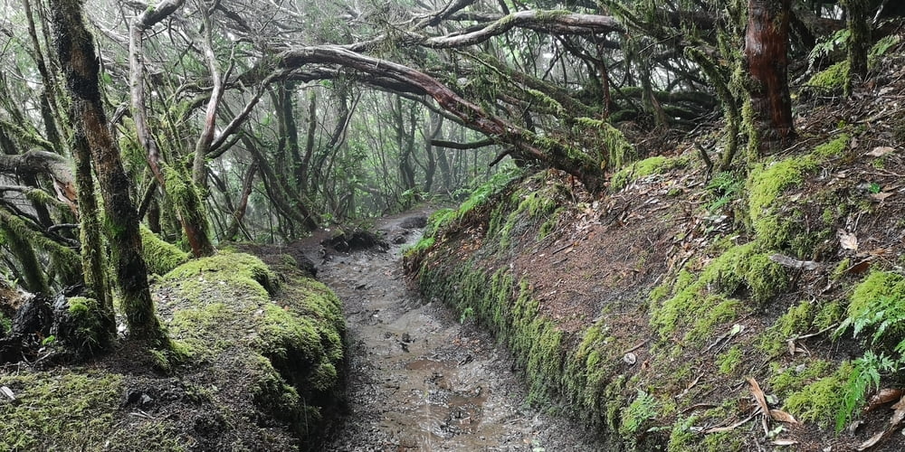
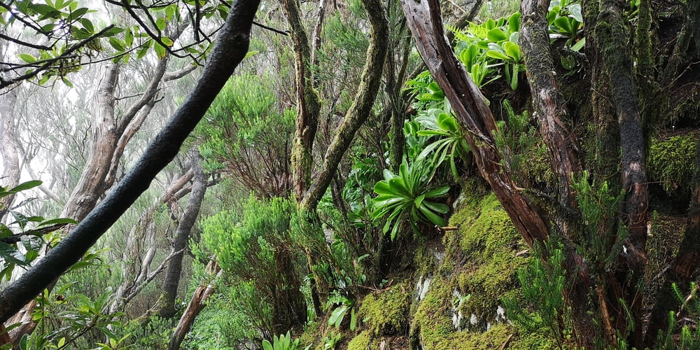
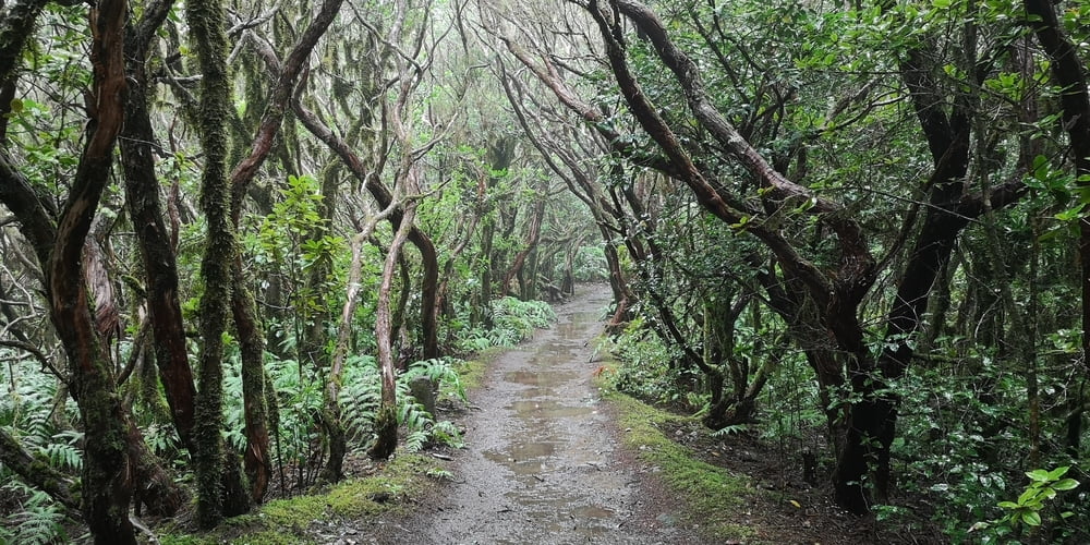
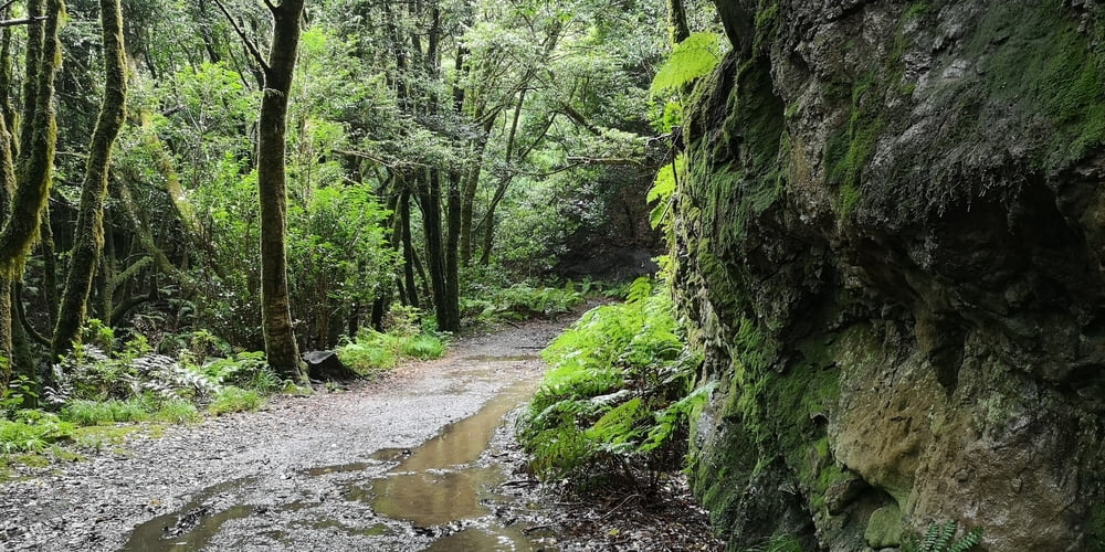
Tour gallery
Tour map and elevation profile
Minimum height 769 m
Maximum height 915 m
More about the tour author
|
|
JoachimDief |
Comments

Parkplatz La Ensillada auf der Anaga Höhenstraße TF-123 (El Bailadero noch Chamorga)
GPS tracks
Trackpoints-
GPX / Garmin Map Source (gpx) download
-
TCX / Garmin Training Center® (tcx) download
-
CRS / Garmin Training Center® (crs) download
-
Google Earth (kml) download
-
G7ToWin (g7t) download
-
TTQV (trk) download
-
Overlay (ovl) download
-
Fugawi (txt) download
-
Kompass (DAV) Track (tk) download
-
Track data sheet (pdf) download
-
Original file of the author (gpx) download
More about the tour author
|
|
JoachimDief |
Add to my favorites
Remove from my favorites
Edit tags
Open track
My score
Rate