

Ödenkirchnerweg incl kurzer Abstecher auf den Hochbühel
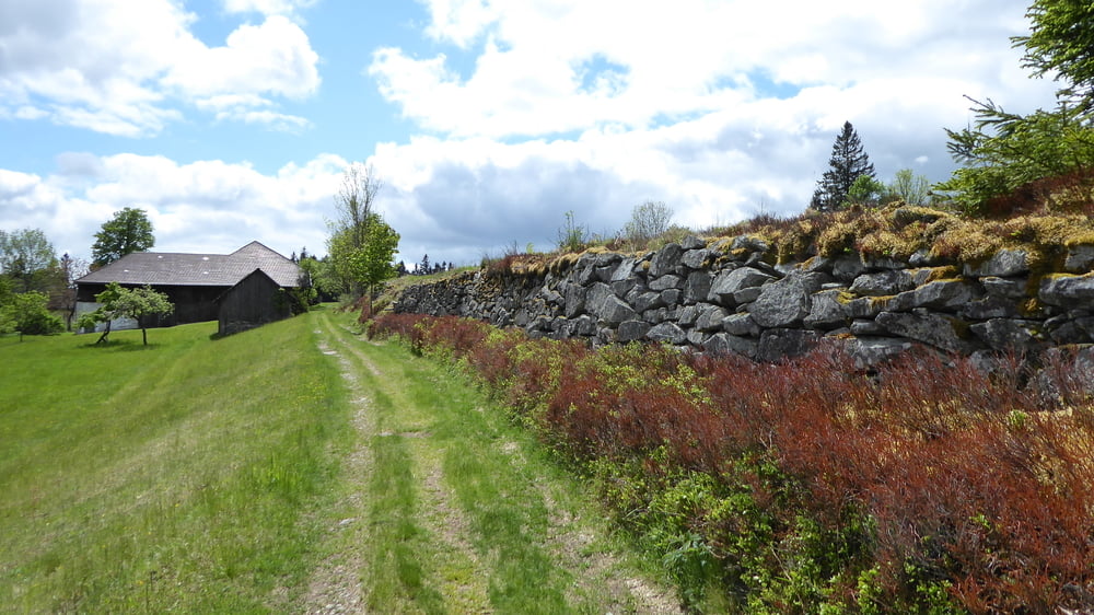
Interessant am Hochbühel selber die Steinmauern im Wald ... als eventueller "Weidezaun" von sehr früher Zeit ev sogar von der Besiedelung des Mühlviertels selbst?! Bei Ödenkirchen haben sich in der Vergangenheit die ersten Zisterzienser niedergelassen aber dieses Gebiet nach ca 7 Jahren wieder verlassen ... der Name Ödenkirchen könnte sich zurückdatieren auf eine Aussage von damals "Öde Kirche"
Tour gallery


Tour map and elevation profile
Minimum height 552 m
Maximum height 886 m
More about the tour author
|
|
Hoar |
Comments

GPS tracks
Trackpoints-
GPX / Garmin Map Source (gpx) download
-
TCX / Garmin Training Center® (tcx) download
-
CRS / Garmin Training Center® (crs) download
-
Google Earth (kml) download
-
G7ToWin (g7t) download
-
TTQV (trk) download
-
Overlay (ovl) download
-
Fugawi (txt) download
-
Kompass (DAV) Track (tk) download
-
Track data sheet (pdf) download
-
Original file of the author (gpx) download
More about the tour author
|
|
Hoar |
Add to my favorites
Remove from my favorites
Edit tags
Open track
My score
Rate