


Gatschach-Weiße Wand-Alm hinterm Brunn-Stosia-
Techendorfer Alm-Weißensee Ostufer-Bodenalm-Paterzipf-
Gatschach
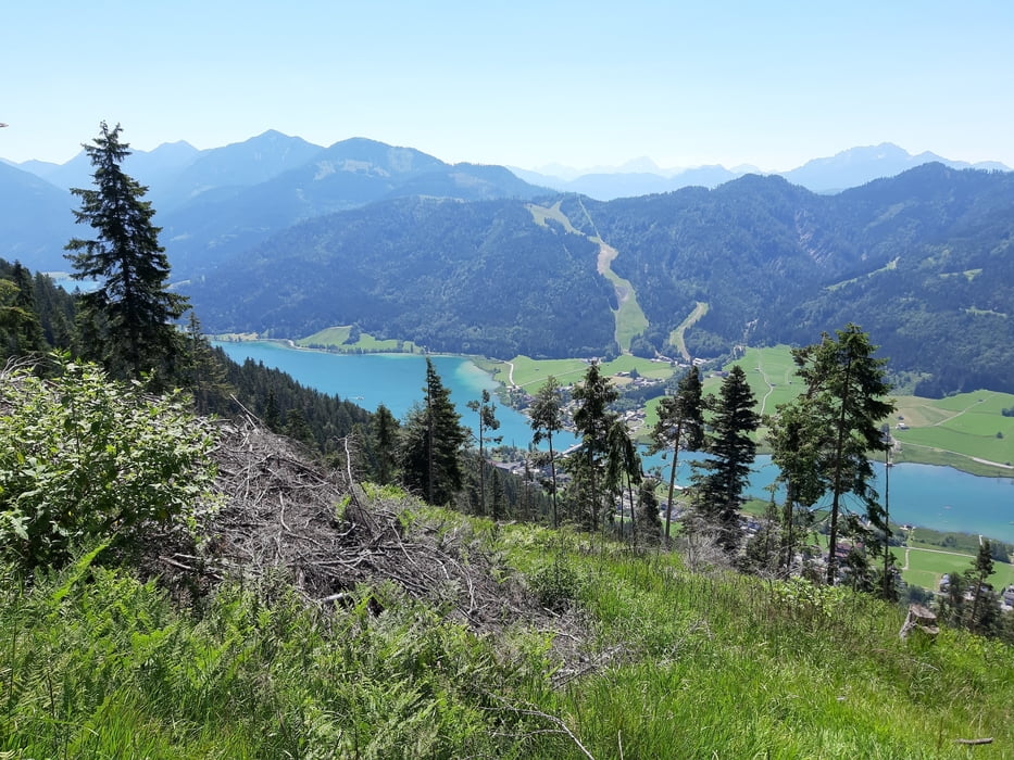
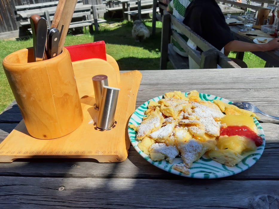
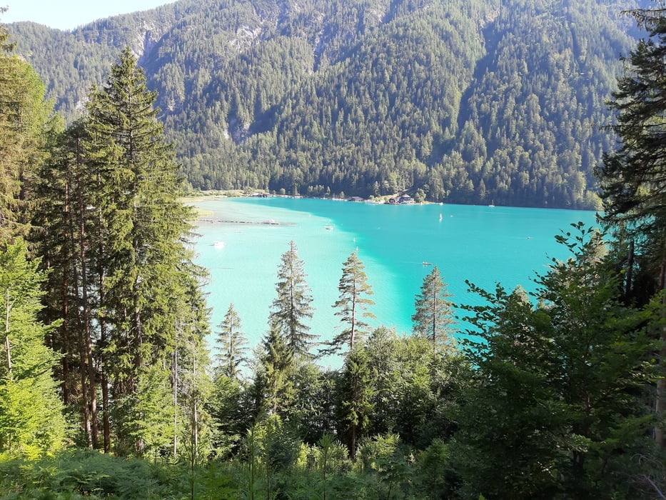
Steil rauf zur Weißen Wand, dann eine kurze Aufwärtsschiebung bis man zum Offiziellen MTB Weg zur Alm hinterm Brunn kommt. Nach der Alm geht’s eine Zeitlang in geringer Steigung einen Forstweg entlang Richtung Stosia. Nordhang, daher schön schattig! Zum Schluss muss man ca 1 Stunde zur Stosia und tw. runter zur Techendorfer Alm schieben. Da hab ich wieder meinen ausgezeichneten Kaiserschmarren bekommen. Nachher auf offiziellen MTB Strecken runter zum Weißensee Ostufer und weiter zur Bodenalm. Da fällts dann ca 300hm ab zum Paterzipf, wo ich wieder ein erfrischendes Bad genommen hab.
Steil rauf zur Weißen Wand, dann eine kurze Aufwärtsschiebung bis man zum Offiziellen MTB Weg zur Alm hinterm Brunn kommt. Nach der Alm geht’s eine Zeitlang in geringer Steigung einen Forstweg entlang Richtung Stosia. Nordhang, daher schön schattig! Zum Schluss muss man ca 1 Stunde zur Stosia und tw. runter zur Techendorfer Alm schieben. Da hab ich wieder meinen ausgezeichneten Kaiserschmarren bekommen. Nachher auf offiziellen MTB Strecken runter zum Weißensee Ostufer und weiter zur Bodenalm. Da fällts dann ca 300hm ab zum Paterzipf, wo ich wieder ein erfrischendes Bad genommen hab.
Tour gallery
Tour map and elevation profile
Minimum height 909 m
Maximum height 1820 m
More about the tour author
|
|
mitter |
Comments

Start in Gatschach am Weißensee.
GPS tracks
Trackpoints-
GPX / Garmin Map Source (gpx) download
-
TCX / Garmin Training Center® (tcx) download
-
CRS / Garmin Training Center® (crs) download
-
Google Earth (kml) download
-
G7ToWin (g7t) download
-
TTQV (trk) download
-
Overlay (ovl) download
-
Fugawi (txt) download
-
Kompass (DAV) Track (tk) download
-
Track data sheet (pdf) download
-
Original file of the author (gpx) download
More about the tour author
|
|
mitter |
Add to my favorites
Remove from my favorites
Edit tags
Open track
My score
Rate