


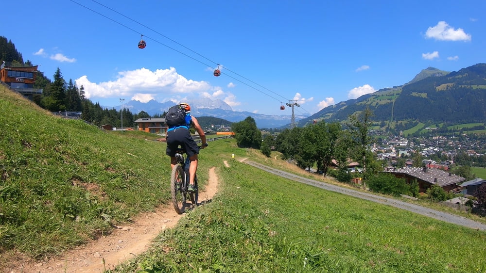
1250 Höhenmeter Uphill auf gut fahrbaren Schotterpisten und fast genau so viele Höhenmeter auf dem Hahnenkammtrail Downhill. Zwischendurch genossen wir noch die Gipfelaussicht vom Pengelstein. Eigentlich wollten wir auf der berühmten Streif bergab nach Kitzbühel fahren - die ist aber inzwischen für Biker gesperrt. Mit dem Hahnenkammtrail fanden wir aber eine würdige Alternative. Ein flowiger Trail, der direkt vom Hahnenkamm bis nach Kitzbühel führt.
Video zur Tour gibt es auf meinem Youtube-Kanal: mountain mane
Tour gallery
Tour map and elevation profile
Minimum height 751 m
Maximum height 1940 m
More about the tour author
|
|
mountain_mane |
Comments

GPS tracks
Trackpoints-
GPX / Garmin Map Source (gpx) download
-
TCX / Garmin Training Center® (tcx) download
-
CRS / Garmin Training Center® (crs) download
-
Google Earth (kml) download
-
G7ToWin (g7t) download
-
TTQV (trk) download
-
Overlay (ovl) download
-
Fugawi (txt) download
-
Kompass (DAV) Track (tk) download
-
Track data sheet (pdf) download
-
Original file of the author (gpx) download
More about the tour author
|
|
mountain_mane |
Add to my favorites
Remove from my favorites
Edit tags
Open track
My score
Rate