Login

Forgotten password?

Cookies have to be accepted!
Your browser's cookie functionality is disabled. Please enable this functionality.

Not a member yet?

Register now
Login

Available for registred users only

Log in to use this feature.

Forgotten password?

Cookies have to be accepted!
Your browser's cookie functionality is disabled. Please enable this functionality.

Not a member yet?

Register now
Filter
Categories
Advanced filters
  • Distance (km)
  • Height
Save filters Reset filter

TrackRank

QRCode

Technical data

Distance67,1 km Height598 m Way down598 m Duration02:14 h:m Date10.11.2020
Scores Author Landscape Fun factor Fitness Technique

Statistics

105 Views Scores 8 Downloads Average
Rate
  • Track data sheet
  • Directions
  • Downloads

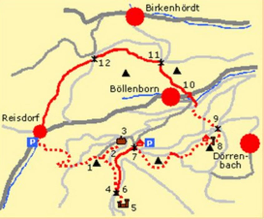
Nach Bad-Bergzabern ehts hoch in den pfälzer Wald.

Schöne Strecker im Wald mit einigen Steigungen.

Beliebt bei Rennrad-Fahrern

Further information at

https://de.wikipedia.org/wiki/Reisdorf_(B%C3%B6llenborn)

Tour map and elevation profile

  • Open Street Map
  • Google
Minimum height 31 m Maximum height 234 m Detailed view

More about the tour author

Herb2202
Member since 2020

Send private message

Comments

Bad-Bergzabern Richtung Dahn.

Dann nach Bad Bergzabern links hoch nach Reisdorf.

Wegen Corona kann man Momentan leider nicht über das Elsaß zurück fahren.

GPS tracks

Trackpoints
  • GPX / Garmin Map Source (gpx) download
  • TCX / Garmin Training Center® (tcx) download
  • CRS / Garmin Training Center® (crs) download
  • Google Earth (kml) download
  • G7ToWin (g7t) download
  • TTQV (trk) download
  • Overlay (ovl) download
  • Fugawi (txt) download
  • Kompass (DAV) Track (tk) download
  • Track data sheet (pdf) download
  • Original file of the author (gpx) download

More about the tour author

Herb2202
Member since 2020

Send private message
Share track
Add to my favorites
Remove from my favorites
Edit tags
My score
Rate
Track: Reisdorf-Bundendahl
Type: Road biking
Distance: 67,1 km
Evaluated on:
Duration:
Day(s)
Hour(s)
Minute(s)
Score: Landscape Fun factor Fitness Technique