Login

Forgot your login?

Cookies have to be accepted!
Your browser's cookie functionality is disabled. Please enable this functionality.

Not a member yet?

Register now
Login

Available for registred users only

Log in to use this feature.

Forgot your login?

Cookies have to be accepted!
Your browser's cookie functionality is disabled. Please enable this functionality.

Not a member yet?

Register now
Filter
Categories
Advanced filters
  • Distance (km)
  • Height
Save filters Reset filter

TrackRank

QRCode

Technical data

Distance10,5 km Height217 m Way down277 m Duration02:30 h:m Date27.02.2021
Scores Author Landscape Fun factor Fitness Technique

Statistics

77 Views Scores 3 Downloads Average
Rate
  • Track data sheet
  • Directions
  • Downloads
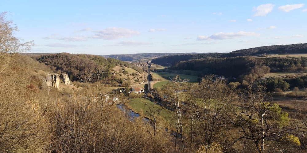
Am Anfang bis Schönfeld fand ich die Wanderung nicht sehr spektakulär. Es geht halt über Felder und durch ein Waldstück. Interessanter wird es nach Schönfeld wenn es dann beim Hagenacker auf Magerrsasen entlang der Bahnlinie geht.

Tour gallery

Tour map and elevation profile

  • Open Street Map
  • Google
Minimum height 382 m Maximum height 517 m Detailed view

More about the tour author

JoachimDief
Member since 2016

Send private message

Comments

Kleiner Parkplatz bei der Brücke über die Altmühl

GPS tracks

Trackpoints
  • GPX / Garmin Map Source (gpx) download
  • TCX / Garmin Training Center® (tcx) download
  • CRS / Garmin Training Center® (crs) download
  • Google Earth (kml) download
  • G7ToWin (g7t) download
  • TTQV (trk) download
  • Overlay (ovl) download
  • Fugawi (txt) download
  • Kompass (DAV) Track (tk) download
  • Track data sheet (pdf) download
  • Original file of the author (gpx) download

More about the tour author

JoachimDief
Member since 2016

Send private message
Share track
Add to my favorites
Remove from my favorites
Edit tags
My score
Rate
Track: Von Dollnstein nach Schönfeld
Type: Hiking
Distance: 10,5 km
Evaluated on:
Duration:
Day(s)
Hour(s)
Minute(s)
Score: Landscape Fun factor Fitness Technique