
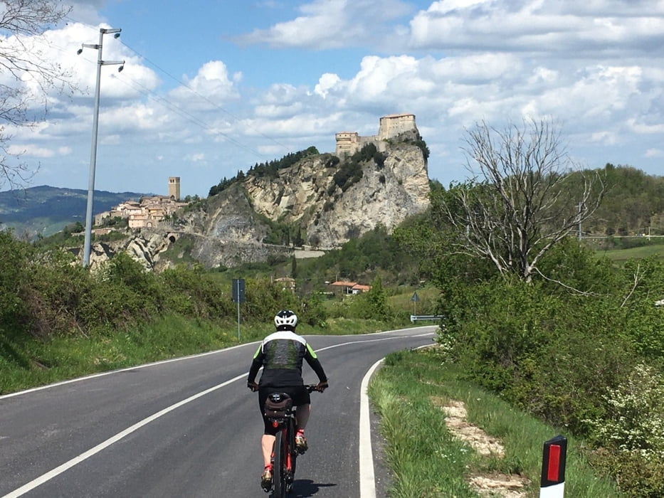

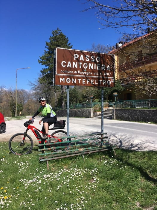
Orte und Pässe an denen man vorbeikommt: Sant'Agata Feltria, Pennabili, P.so Cantoniera (1007m) höchster Punkt, Carpegna, Villagrande, Serra San Marco (1006m), San Leo, Novafeltria.
Die Tour befindet sich im herrlichen Montefeltro, Land der tausend Hügel und Burgen. Die Gegend ist etwas abgeschieden und daher mit sehr wenig Verkehr.
Wem die Höhenmeter zu wenig sind kan noch den Monte Carpegna 1362m (Pantanis Trainingsstrecke) mitnehmen.
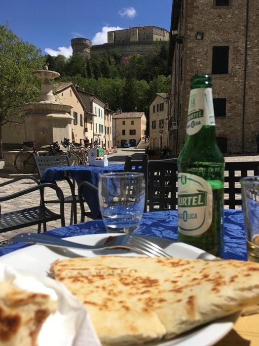
In San Leo gibt es im "Castel" sehr leckere Piadine und auch einen Brunnen zum füllen der Radflaschen.
Natürlich kann man überall entlang der Strecke starten.
Further information at
https://emiliaromagnaturismo.it/en?utm_source=ERT&utm_medium=menuTour gallery
Tour map and elevation profile
Minimum height 231 m
Maximum height 1016 m
More about the tour author
|
|
Califan |
Comments

kostenloser Parkplatz, auch für Wohnmobile.
GPS tracks
Trackpoints-
GPX / Garmin Map Source (gpx) download
-
TCX / Garmin Training Center® (tcx) download
-
CRS / Garmin Training Center® (crs) download
-
Google Earth (kml) download
-
G7ToWin (g7t) download
-
TTQV (trk) download
-
Overlay (ovl) download
-
Fugawi (txt) download
-
Kompass (DAV) Track (tk) download
-
Track data sheet (pdf) download
-
Original file of the author (gpx) download
More about the tour author
|
|
Califan |
Add to my favorites
Remove from my favorites
Edit tags
Open track
My score
Rate