


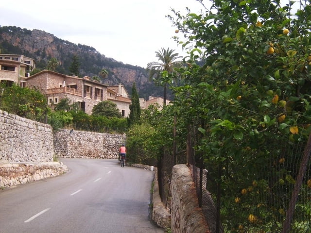
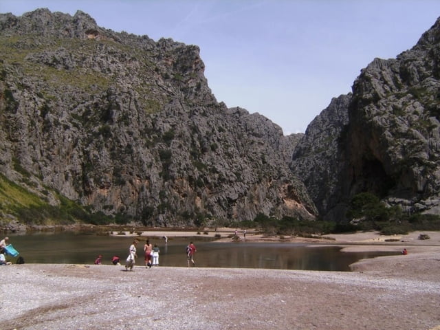
Wir parkten das Leihauto in Port Soller. Nach einem Besuch des Ortszentrums von Soller Auffahrt über Biniaraix, durch die Obstgärten von Fornalutx zur Hauptstraße C 710 und auf dieser zum Coll de Puig Major, nach Hürzelerkarte auf 960m. Hier ein dunkles Tunnel, Licht empfehlenswert! Nun Abfahrt an zwei schönen Stauseen vorbei und vor einem Viadukt nach links abzweigen. Auffahrt ca. 150 Höhenmeter zum Calobrapass. Nun durch den sogenannten "Krawattenknoten" in herrlicher Fahrt die 800 Höhenmeter, eine Serpentine nach der anderen, zum Strand und Hafen von Sa Calobra. Zu Fuß in wenigen Minuten in die Schlucht Torrent de Pareis.
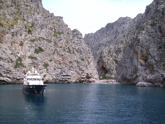
Rückfahrt nach Port Soller mit dem Schiff. Aber Vorsicht: letztes Schiff legt um 16.30 Uhr ab. Fahrpreis Mai 2008: 16 Euro/Person einschl. Fahrrad.
Diese Fahrradtour kann natürlich mit jedem anderen Rad, besonders auch mit dem Rennrad, gefahren werden. Wir hatten nur MTBs dabei.
Soller ist mit dem Leihauto von allen Strandhotels der Insel erreichbar. Wir starteten in Santa Ponca Nähe Peguera, genau so weit ist es von Alducia aus, etwas weiter vom östlichen Eck der Insel. z.B. Cala Rajada.
Further information at
http://hotelbahiadealcudia.com/Mallorca-Hotel/index.phpTour gallery

Tour map and elevation profile
Minimum height -2 m
Maximum height 872 m
More about the tour author
|
|
herzi |
Comments

GPS tracks
Trackpoints-
GPX / Garmin Map Source (gpx) download
-
TCX / Garmin Training Center® (tcx) download
-
CRS / Garmin Training Center® (crs) download
-
Google Earth (kml) download
-
G7ToWin (g7t) download
-
TTQV (trk) download
-
Overlay (ovl) download
-
Fugawi (txt) download
-
Kompass (DAV) Track (tk) download
-
Track data sheet (pdf) download
-
Original file of the author (gpx) download
More about the tour author
|
|
herzi |
Add to my favorites
Remove from my favorites
Edit tags
Open track
My score
Rate