


Diese Skitour, die zum Schluß im Pistengelände von Ischgl/Samnaun endet, wurde von uns gewählt, um nach einem verlängerten Skiwochenende nicht den ewig langen Ziehweg nach Ischgl befahren zu müssen.
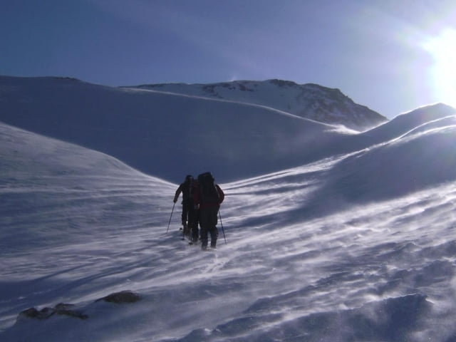
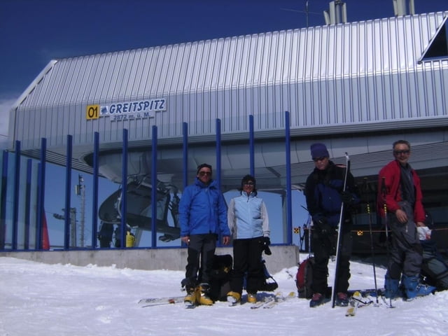
Aufstieg ca. 500 Hm nach Nordosten zu einer Scharte rechts neben dem Piz Val Gronda. Nun ca. 350 Hm Abfahrt in nicht ganz lawinensicherem Gelände und Gegenanstieg gut 300 Hm in eine Scharte. Für die nächste kurze Abfahrt von ca. 100 Hm lohnt sich das abfellen kaum. Nun kommt der flache Schlußanstieg zur Greitspitze. Mit diesem Gipfel ist der höchste Punkt erreicht und es folgte eine ewig lange Pistenabfahrt, vorbei am Trubel der Idalpe.
Insgesamt sind ca. 1100 Hm im Aufstieg zu bewältigen, aber 2000 Hm Abfahrt entlohnen sicher diese kleine Mühe!
Further information at
http://www.dav-teisendorf.de/berichte/av_touren/2008/silvretta/index.htmTour gallery
Tour map and elevation profile
Minimum height 1354 m
Maximum height 2872 m
More about the tour author
|
|
herzi |
Comments

GPS tracks
Trackpoints-
GPX / Garmin Map Source (gpx) download
-
TCX / Garmin Training Center® (tcx) download
-
CRS / Garmin Training Center® (crs) download
-
Google Earth (kml) download
-
G7ToWin (g7t) download
-
TTQV (trk) download
-
Overlay (ovl) download
-
Fugawi (txt) download
-
Kompass (DAV) Track (tk) download
-
Track data sheet (pdf) download
-
Original file of the author (gpx) download
More about the tour author
|
|
herzi |
Add to my favorites
Remove from my favorites
Edit tags
Open track
My score
Rate