


Grenoble is surrounded by three mountain ranges: Chartreuse, Vercors and Belledonnes. During this trip we visited lower parts of the Belledonnes.
The trip is short and close to Grenoble, but requires some climbing to reach all the forts in this area. Most of the forts are not open for visitors, but reaching them is fun itself.
Start climbing at la Galochere to quickly reach Fort la Murrier. A guided visit was announced to be possible each saturday at 3 pm, but due to some works we could not visit the fort and ended up spending a while on a nearby park-hill.
Enjoy the remarkable views while climbing further to reach Fort des Quatre Seigneurs. The fort itself was closed and the surroundings were uninteresting, but it is on the way to Herbeys anyway, so why not climb it ;-)
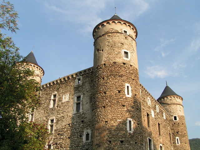
The castle in Herbeys is a private property and is not open for visitors, but you can have a broad view on it while following D112 road.
Begin a second climb in Tavernolles to reach Fort de Montavie. It is dangerous to enter it, but it is interestingly melted with the surrounding nature.
On the way back do not miss the old castle at les Chaberts. You may also rest in the "Le Lac" natural reserve.
Return to Grenoble through Echirolles.
The trip is short and close to Grenoble, but requires some climbing to reach all the forts in this area. Most of the forts are not open for visitors, but reaching them is fun itself.
Start climbing at la Galochere to quickly reach Fort la Murrier. A guided visit was announced to be possible each saturday at 3 pm, but due to some works we could not visit the fort and ended up spending a while on a nearby park-hill.
Enjoy the remarkable views while climbing further to reach Fort des Quatre Seigneurs. The fort itself was closed and the surroundings were uninteresting, but it is on the way to Herbeys anyway, so why not climb it ;-)
The castle in Herbeys is a private property and is not open for visitors, but you can have a broad view on it while following D112 road.
Begin a second climb in Tavernolles to reach Fort de Montavie. It is dangerous to enter it, but it is interestingly melted with the surrounding nature.
On the way back do not miss the old castle at les Chaberts. You may also rest in the "Le Lac" natural reserve.
Return to Grenoble through Echirolles.
Tour gallery
Tour map and elevation profile
Minimum height 212 m
Maximum height 914 m
More about the tour author

|
azzie |
Comments

As usual you can start anywhere in Greoble ;-)
If you feel like taking two shorter climbs is better than only one but long, try doing the trip in opposite direction.
If you feel like taking two shorter climbs is better than only one but long, try doing the trip in opposite direction.
GPS tracks
Trackpoints-
GPX / Garmin Map Source (gpx) download
-
TCX / Garmin Training Center® (tcx) download
-
CRS / Garmin Training Center® (crs) download
-
Google Earth (kml) download
-
G7ToWin (g7t) download
-
TTQV (trk) download
-
Overlay (ovl) download
-
Fugawi (txt) download
-
Kompass (DAV) Track (tk) download
-
Track data sheet (pdf) download
-
Original file of the author (gpx) download
More about the tour author
|
|
azzie |
Add to my favorites
Remove from my favorites
Edit tags
Open track
My score
Rate