


Von Canazei folgen wir aus Zeitgründen der Autostrasse bis Moena hier ist der Radweg Canazei –Moena empfehlenswert. Von Moena geht’s auf Schotterwegen bis zum Karrerpass.
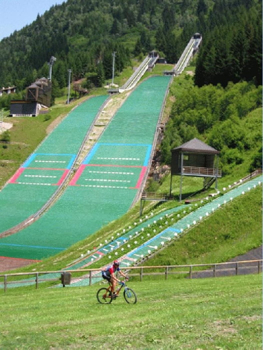
Nach kurzer Asphalt Abfahrt geht links auf schönen Schotterwegen zum Karrersee und weiter nach Obereggen wo man wieder auf Asphaltstrasse bis zum Reiterjoch folgt. Bei der Zischgalm (nette Einkehrmöglichkeit)gehts nun schiebend zum Passo Feudo. Auf sehr steilen Schotterstrassen fährt man nun bis Predazzo hinunter. Vorbei an der Skisprunganlage geht’s dem Radweg entlang zurück nach Moena und Canazei.
Nach kurzer Asphalt Abfahrt geht links auf schönen Schotterwegen zum Karrersee und weiter nach Obereggen wo man wieder auf Asphaltstrasse bis zum Reiterjoch folgt. Bei der Zischgalm (nette Einkehrmöglichkeit)gehts nun schiebend zum Passo Feudo. Auf sehr steilen Schotterstrassen fährt man nun bis Predazzo hinunter. Vorbei an der Skisprunganlage geht’s dem Radweg entlang zurück nach Moena und Canazei.
Tour gallery
Tour map and elevation profile
Minimum height 1088 m
Maximum height 2168 m
More about the tour author

|
Comments
Brennerautobahn Ausfahrt Klausen
Über Grödnerjoch und Sellajoch nach Canazei
Albergo Al Viel
Über Grödnerjoch und Sellajoch nach Canazei
Albergo Al Viel
GPS tracks
Trackpoints-
GPX / Garmin Map Source (gpx) download
-
TCX / Garmin Training Center® (tcx) download
-
CRS / Garmin Training Center® (crs) download
-
Google Earth (kml) download
-
G7ToWin (g7t) download
-
TTQV (trk) download
-
Overlay (ovl) download
-
Fugawi (txt) download
-
Kompass (DAV) Track (tk) download
-
Track data sheet (pdf) download
-
Original file of the author (g7t) download
More about the tour author
|
|
Add to my favorites
Remove from my favorites
Edit tags
Open track
My score
Rate
latemar