Login

Forgotten password?

Cookies have to be accepted!
Your browser's cookie functionality is disabled. Please enable this functionality.

Not a member yet?

Register now
Login

Available for registred users only

Log in to use this feature.

Forgotten password?

Cookies have to be accepted!
Your browser's cookie functionality is disabled. Please enable this functionality.

Not a member yet?

Register now
Filter
Categories
Advanced filters
  • Distance (km)
  • Height
Save filters Reset filter

TrackRank

QRCode

Technical data

Distance3,0 km Height462 m Way down389 m Duration00:00 h:m Date12.10.2008
Scores Author Landscape Fun factor Fitness Technique

Statistics

2838 Views Scores 45 Downloads Average
Rate
  • Track data sheet
  • Directions
  • Downloads
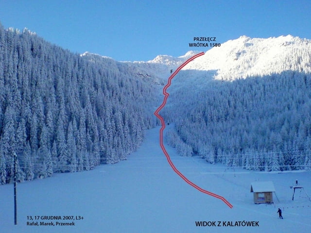
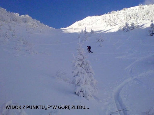
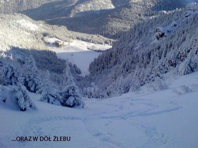
Suchy Żleb to szybka i dość łatwa skitura, za to zjazd fantastyczny choć niezbyt długi.

Tour gallery

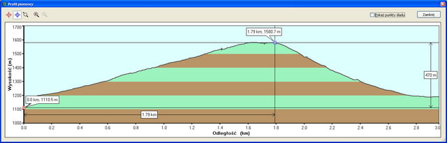
Tour map and elevation profile

  • Open Street Map
  • Google
Minimum height 1110 m Maximum height 1585 m Detailed view

More about the tour author

przemski
Member since 2008

Send private message

Comments

Dojazd z Zakopanego do Kuźnic, skąd około 20 minut marszu do hotelu górskiego na polanie Kalatówki.

GPS tracks

Trackpoints
  • GPX / Garmin Map Source (gpx) download
  • TCX / Garmin Training Center® (tcx) download
  • CRS / Garmin Training Center® (crs) download
  • Google Earth (kml) download
  • G7ToWin (g7t) download
  • TTQV (trk) download
  • Overlay (ovl) download
  • Fugawi (txt) download
  • Kompass (DAV) Track (tk) download
  • Track data sheet (pdf) download
  • Original file of the author (gpx) download

More about the tour author

przemski
Member since 2008

Send private message
Share track
Add to my favorites
Remove from my favorites
Edit tags
My score
Rate
Track: Suchy Żleb (z Kalatówek)
Type: Ski touring
Distance: 3,0 km
Evaluated on:
Duration:
Day(s)
Hour(s)
Minute(s)
Score: Landscape Fun factor Fitness Technique