


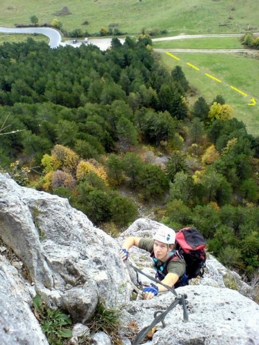
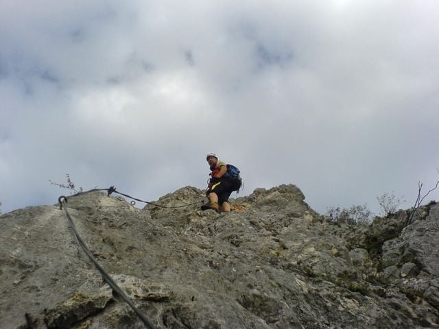
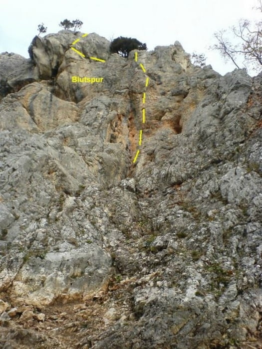
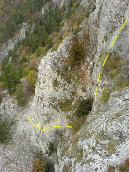
Schöner, knackiger Klettersteig.Vom Sonnenuhr-Parkplatz über die Wiese ansteigend bis zum Wandfußsteig, dann leicht rechtshaltend bis zum Einstieg (15 min.). Am Anfang ist gleich die schwierigste Stelle des HTL Steiges (D/E), der sich sehr schön durch die Wand schlingelt. Der Steig teilt sich in 3 Teile, wobei wir hier nach dem 2. Teil den Klettersteig "Blutspur (D/E" weitergestiegen sind.
Abstieg über die Völlerin (beim Startplatz der Paragleiter) zurück zum Ausgangspunkt.
Zustieg: 15. min
HTL + Blutspur 1:00
Abstieg: 40 min
Gesamt 1:55
Tour gallery
Tour map and elevation profile
Minimum height 587 m
Maximum height 885 m
More about the tour author
|
|
renrew |
Comments

Autobahnabfahrt A2 Wr. Neustadt West - Wegweiser Hohe Wand - Richtung Weikersdorf - Winzendorf - Gaaden und Stollhof bis zur Abzweigung der Hohen Wand Straße. Dieser bis zur 1. Kehre, dem Sonnenuhr-Parkplatz, folgen
GPS tracks
Trackpoints-
GPX / Garmin Map Source (gpx) download
-
TCX / Garmin Training Center® (tcx) download
-
CRS / Garmin Training Center® (crs) download
-
Google Earth (kml) download
-
G7ToWin (g7t) download
-
TTQV (trk) download
-
Overlay (ovl) download
-
Fugawi (txt) download
-
Kompass (DAV) Track (tk) download
-
Track data sheet (pdf) download
-
Original file of the author (gpx) download
More about the tour author
|
|
renrew |
Add to my favorites
Remove from my favorites
Edit tags
Open track
My score
Rate